Home › Categories › Raster & terrain › Page 9
Raster & terrain QGIS plugins Page 9 of 10
QGIS plugins to analyse rasters, elevation models and terrain. 600 plugins, 264 QGIS 4 ready, 424 actively maintained. Sorted by downloads. Showing 481–540.
Related categories: Vector tools · Spatial analysis · Remote sensing · Georeferencing & CAD · Hydrology & water · All categories
- RS DAF Raster DownloadQGIS 4 ready
Build Datafordeler download URLs from map extent, selection, or drawn rectangle (EPSG:25832).
- EarthWorkQQGIS 4 ready
Earthwork quantities for sites and road corridors: weighted grid integration and end-area sections, void-ratio volume conversion, daylighted
- FlipFlopNot QGIS 4 ready
Plugin that allows you to show/hide a defined set of layers using a keyboard shortcut.
- Acervo SIG - CPRMQGIS 4 ready
Catalogo do acervo GEOSGB do Servico Geologico do Brasil (SGB/CPRM) diretamente no QGIS: pesquise, baixe e adicione dados ao projeto. Catal
- HELIX Labelling FrameworkQGIS 4 ready
Prepare robust vector and raster label workflows on a common reference grid, from class schemes and temporal alignment to context features,
- route-plannerNot QGIS 4 ready
Calculating the best route between two chosen point in terrain conditions.
- PixieNot QGIS 4 ready
Measure pixel distances on raster images for scale calibration
- IGN AltibonneQGIS 4 ready
Altibonne is a Python plugin that allows visualizing and correcting elevation profiles on linear features.
- AutoGR BridgeNot QGIS 4 ready
Launch AutoGR-SIFT from QGIS and automatically import georeferenced results.
- ApexNadirNot QGIS 4 ready
Extracts the absolute highest (apex) or lowest (nadir) elevation points inside vector polygon boundaries using DEM raster datasets.
- GeomorphKitNot QGIS 4 ready
A high-performance, multiscale geomorphometry suite featuring memory-chunking and Numba-accelerated Geomorphon generation.
- Limiti GeoNot QGIS 4 ready
Intersects a DTM file and a geological plane, given dip and dip direction
- Sen Couverture TerrestreNot QGIS 4 ready
Per-commune analysis for Senegal: Sentinel-2 land cover (Living Atlas), soil type and estimated fertility (Morpho_Pedo), and relief (DEM).
- AriesGeo ToolboxQGIS 4 ready
Geospatial productivity suite: Place Finder, AriesGapfill (Landsat 7 SLC-off repair), Mosaic & Cloud Remover, Map Layout Assistant, and Terr
- TransformToolbarQGIS 4 ready
Replicates the Manifold System Release 8.0 transform toolbar (target, operator, parameter) for vectors and rasters
- Raster ImporterQGIS 4 ready
Imports raster images and optionally adjusts them immediately to the current map view.
- Raster Statistics Along LineQGIS 4 ready
Computes raster statistics along vector line features.
- FricMapsQGIS 4 ready
FricMaps: A Tool for Modeling Landscape Connectivity and Fence Permeability.
- LandXML Surface ToolsNot QGIS 4 ready
QGIS plugin to convert elevation rasters into LandXML TIN surfaces and run quality control on the result.
- Extent matcherNot QGIS 4 ready
match raster's extent to target raster
- Raster Loader +QGIS 4 ready
Plugin for managing large raster datasets, loading and copying.
- USGS 3DEP DownloaderNot QGIS 4 ready
Download USGS 3DEP DEM GeoTIFFs for the current QGIS map view
- Classificador de DeclividadeNot QGIS 4 ready
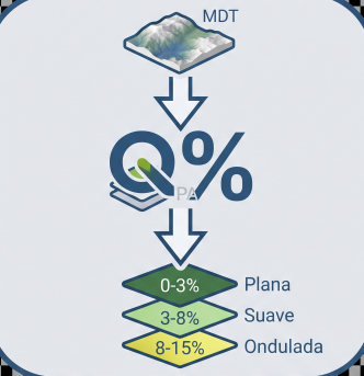
Classifies a DEM into polygons by user-defined slope ranges and calculates adaptive earthwork by class.
- CUDA Raster AcceleratorNot QGIS 4 ready
CUDA/CuPy raster accelerator for selected raster layers with an in-plugin CUDA runtime installer. Processes GeoTIFF blocks with optional NV
- oceanum-datameshQGIS 4 ready
Search, query, load and display Oceanum Datamesh ocean & environmental data directly in QGIS.
- QuickBDOTQGIS 4 ready
Download, select, export and visualize Polish BDOT10k topographic data directly in QGIS.
- QCT NZ Elevation & Imagery ImporterNot QGIS 4 ready
Streams LINZ nz-elevation LiDAR DEM/DSM tiles (via GDAL /vsicurl/) straight into the current project from a manageable dataset database. Par
- ROI BrushNot QGIS 4 ready
A pixel-aware paint brush-like tool for ROI creation over rasters.
- CoastProfileQGIS 4 ready
Multiannual monitoring of beach and dune topographic profiles, GNSS quality control and erosion assessment.
- Remove Temporary LayersQGIS 4 ready
Review and safely remove temporary layers (vector, raster, mesh, point cloud) from your QGIS project.
- OpenStaR-Elec DéploiementQGIS 4 ready
Create a business environment within an "OpenStaR-Elec Récolement" QGIS profile for mapping electrical networks in StaR-Elec, the new French
- Contour LabelerQGIS 4 ready
Place slope-aligned elevation labels on contours along guide lines drawn uphill.
- Stack Bands S2Not QGIS 4 ready
Stack raster bands (e.g. Sentinel-2) into a single GeoTIFF while preserving each band's name
- Raster ScatterQGIS 4 ready
Plots two raster datasets against each other and fits a linear regression.
- Q-GlaRe+Not QGIS 4 ready
Q-GlaRe+ reconstructs the 3D surface elevation and ice thickness of palaeo- and extant glaciers from digitised flowlines, and facilitates ca
- SDU Agro ToolsQGIS 4 ready
A collection of tools for agricultural use. Including color segmentation and crop row detection.
- DEM Debris Flow GradientNot QGIS 4 ready
Batch calculates debris-flow main-channel longitudinal gradient from DEM using watershed polygons or outlet points.
- StereonetStudioQGIS 4 ready
Professional stereographic projection (stereonet): polar/equatorial grid, poles, density contours, rose diagram, kinematic analysis (planar
- VaquerosGISNot QGIS 4 ready
Base cartográfica de Tamaulipas (México) lista para trabajar: imagen de satélite, relieve, estado, municipios con su nombre, distritos de ri
- GeoLensQGIS 4 ready
Browse, visualize, and edit datasets hosted by a GeoLens server.
- Raster Area CalculatorNot QGIS 4 ready
Calculate raster class areas and write them into the Raster Attribute Table, with pixel size shown in the dialog and a context-menu icon.
- DoD Detection ToolNot QGIS 4 ready
Terrain change detection tool using the Digital Terrain Model of Difference (DoD) method.
- MDE AP - Acurácia PosicionalNot QGIS 4 ready
Evaluates three-dimensional positional accuracy of Digital Elevation Models (DEM) using homologous linear features (PEC-PCD and CE90/LE90).
- PickShiftQGIS 4 ready
PickShift: Monte-Carlo estimation of positional and area uncertainty of polygons from GCP planimetric biases.
- Landslide & Erosion (PETA ALAM)Not QGIS 4 ready
Analisis otomatis tanah longsor dan likuifaksi, disertai analisis erosi menggunakan metode USLE dan SMCE, serta penilaian dampak kepadatan p
- NISAR ProcessorQGIS 4 ready
QGIS toolbox for NISAR Level-2 GCOV product inspection, scientific raster extraction, visualization, quality layers, and analysis-ready rast
- Raster TransformQGIS 4 ready
Move, rotate and scale raster layers without resampling the original pixels. The transformation is stored in the GeoTIFF affine georeferenci
- Meteo Grid StatisticsNot QGIS 4 ready
Time-aware polygon statistics for regular NetCDF, GRIB and GeoTIFF grids; requires GDAL/OGR and NumPy supplied with QGIS 3.
- RichDEMNot QGIS 4 ready
Terrain analysis algorithms from the RichDEM library
- CoverCraft - Internet Coverage MapperNot QGIS 4 ready
Turn BTS towers into coverage maps in QGIS: model cellular/internet signal, find the blank spots, and get suggested new tower sites — over r
- Forest PlannerQGIS 4 ready
From forest census to management plan: drainage network, riparian buffers, log landings, skid trails, haul roads and impact areas for Amazon
- SATHIQGIS 4 ready
SATHI: Spatial Aggregation, Temporal Harmonization & Interpolation for geometry-aware climate-grid extraction, spatial statistics, interpola
- Parcel Watershed DelineationNot QGIS 4 ready
Delineates a single watershed for one or more parcels using one or more DEMs.
- Quick Raster StatisticsNot QGIS 4 ready
Draw an area on a raster and inspect fast, in-memory per-band statistics.
- TopoFastQGIS 4 ready
Draw an area on the map and automatically get the DEM (OpenTopography) and its contour lines with a single click.
- ArtefactJugaadQGIS 4 ready
Corrects localized raster artefacts using reference raster replacement or interpolation while preserving the original raster grid.
- GeoRisk PulseNot QGIS 4 ready
Generate a transparent, user-defined Composite Environmental Risk Index from weighted, normalized raster indicators.
- RasterNinjaNot QGIS 4 ready
RasterNinja is a compact, extensible QGIS plugin for raster & DEM workflows - draw a polygon or use an existing mask layer to crop/clip rast
- Historical Image GeoreferencerNot QGIS 4 ready
Georeference historical imagery with interactive GCPs, live preview, GeoTIFF export, and direct PostGIS Raster upload.
- Natural Breaks Raster SymbologyNot QGIS 4 ready
Classify and symbolize raster layers with Natural Breaks (Jenks), Equal Interval, or Quantile, with an optional histogram preview.