
Home › Hydrology & water › DEM Debris Flow Gradient
DEM Debris Flow Gradient QGIS 4 compatibility
Not QGIS 4 ready Active
Not yet — the latest version declares max QGIS version 3.99.0, so it is not offered to QGIS 4 users.
Batch calculates debris-flow main-channel longitudinal gradient from DEM using watershed polygons or outlet points.
About
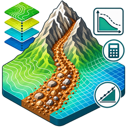
DEM Debris Flow Gradient is a QGIS raster-analysis plugin for rapid calculation of debris-flow main-channel longitudinal gradient from DEM data. It provides two workflows: DEM with existing watershed polygons, or DEM with outlet points and automatic watershed delineation. The workflow includes depression filling, D8 flow direction, flow accumulation, outlet determination or snapping, watershed extraction, main-channel tracing, elevation-difference calculation and longitudinal-gradient calculation. Outputs include main-channel vectors, automatically delineated watershed polygons in outlet-point mode, and CSV statistics. GeoPackage, Shapefile and GeoJSON are supported. Results should be visually checked before engineering or hazard-assessment use. Method reference: Zhang Su, Rapid Calculation Method of Debris-Flow Watershed Longitudinal Gradient Based on DEM, 2018(09): 238-239. This plugin independently implements and extends the workflow, including automatic watershed delineation from outlet points.
| Author | Zhang Y.H. |
|---|---|
| Downloads | 280 |
| Latest version | 1.0.1 |
| Last updated | 2026-09-04 (42 days ago) |
| Min QGIS | 3.28.0 |
| Max QGIS | 3.99.0 |
| QGIS 4 ready | No |
| Maintenance | Active |
| Categories | Hydrology & water, Raster & terrain |
| Tags | dem, debris flow, hydrology, watershed, terrain analysis, longitudinal gradient |
Homepage · Repository · Issue tracker · Official page
Alternatives in Hydrology & water
- CrayfishQGIS 4 ready
Tools for mesh layers QGIS
- ArcGeek CalculatorQGIS 4 ready
ArcGeek Calculator is a QGIS plugin that provides a comprehensive set of tools for coordinate calculations, conversions, spatial operations,
- TUFLOWQGIS 4 ready
A collection of utilities for TUFLOW flood and coastal simulation in QGIS



Related plugins
- Not-So-QT-DEMQGIS 4 ready
TauDEM 5.3 processing provider
- Basdonax Keyline from DEMQGIS 4 ready
Computational design of Keyline infiltration lines from DEM/DTM.
- Isoliner - грид и изолинииQGIS 4 ready
2D kriging (GSLIB KB2D) and isoline / contour-polygon generation in QGIS. Кригинг 2D (GSLIB KB2D) и построение изолиний/контурных полигонов
- MAS Spatial Analysis ToolQGIS 4 ready
Comprehensive DEM analysis toolkit with 45+ hydrological, geomorphometric, and stream network tools. Numba-accelerated for fast processing.
- basinkitQGIS 4 ready
Click a river anywhere on Earth and get an analysis-ready basin package: elevation, terrain surfaces, land cover, soil, rainfall, surface wa
- AriesGeo ToolboxQGIS 4 ready
Geospatial productivity suite: Place Finder, AriesGapfill (Landsat 7 SLC-off repair), Mosaic & Cloud Remover, Map Layout Assistant, and Terr





Maintenance: Active = updated within 1 year, Quiet = 1–3 years, Likely abandoned = over 3 years.