Home › Categories › Vector tools › Page 5
Vector tools QGIS plugins Page 5 of 14
QGIS plugins to edit geometries, attributes and vector layers. 798 plugins, 290 QGIS 4 ready, 463 actively maintained. Sorted by downloads. Showing 241–300.
Related categories: Georeferencing & CAD · Raster & terrain · Spatial analysis · Web maps & export · Cartography & layout · All categories
- MultiJoinQGIS 4 ready
Join in a new layer n fields taken from other n layer having the same field
- Polygon from map extentNot QGIS 4 ready
A lightweight QGIS plugin to make a polygon from the current map extent.
- Quick Shape UpdateNot QGIS 4 ready
Automatic update of the shapes length and/or area in the selected layer
- LeafmapQGIS 4 ready
A QGIS plugin for interactive layer comparison with transparency control and swipe tools.
- HouseNumbering3Not QGIS 4 ready
HouseNumbering3 plugin is a quick and handy way to input increasing field value for selected elements in the current/active layer.
- Move lines on points by attributeNot QGIS 4 ready
Move lines on points by attribute (and vice versa)
- eKMap Server PublisherNot QGIS 4 ready
Publisher plugin for eKMap Server
- AddPointNot QGIS 4 ready
Create point features from user-entered coordinates through a simplified interface.
- Minimum Spanning TreeNot QGIS 4 ready
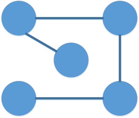
This plugin creates minimum spanning trees in multiple ways.
- Attribute SearcherNot QGIS 4 ready
A minimalistic plugin to search for values in attributes quick and easy.
- Nearest with greater valueQGIS 4 ready
Get name (or ID) of and distance to the nearest feature with greater value in a certain field of a point layer. Returns point layer with add
- QGIS DashboardQGIS 4 ready
Build ArcGIS-Dashboards-style interactive dashboards from your QGIS project layers — indicators, charts, lists, a live map element, and cros
- Geology toolsQGIS 4 ready
Geology Tools offers a collection of plugins that simplify workflows in geology, hydrogeology, and seismic microzonation
- CalcOnfieldQGIS 4 ready
Calculus on field - Calcoli su campo
- Configurable searchNot QGIS 4 ready
Attribute search based on config file
- QuickRectangleCreatorNot QGIS 4 ready
QuickRectangleCreator allows you to create a rectangle quickly and easily, preset sizes, snap to grid and rotate on the fly.
- BOSNot QGIS 4 ready
Assess the quality (including geometric accuracy) of a line data set by comparing it to a line data set of significantly higher accuracy usi
- EnviFateNot QGIS 4 ready
EnviFate: Open source tool for environmental risk analysis
- Reverse Flow DirectionNot QGIS 4 ready
This Plugin changes the direction of a polyline feature.
- CSV Geometry ImportQGIS 4 ready
Import CSV files with various geometry formats (WKT, WKB, GeoJSON, KML, Earth Engine, TopoJSON, X-Y coordinates). Part of MAS Vector Process
- Easy Feature SelectorQGIS 4 ready
The Easy Feature Selector plugin helps you select and examine vector layer features by their attribute values. Works with any vector layer a
- QuickPolygonRepairQGIS 4 ready
Das Plugin prüft einen aktivierten Polygon-Layer auf Geometriefehler und bietet an, diese auch zu reparieren / The plugin checks an activate
- Fit Geometry by AreaNot QGIS 4 ready
This plugin lets you change the geometry by a field that have a area value you want fit it.
- NavtableNot QGIS 4 ready
NavTable is a QGIS plugin to view in a agile way the records of vectorial geographical information layers.
- Offset LinesNot QGIS 4 ready
This plugin lets you offset lines parallel to its original in a variable distance
- USM toolset (Urban Sprawl Metric toolset)QGIS 4 ready
The USM Toolset calculates Weighted Urban Proliferation (WUP) and its components (PBA, DIS, LUP) for user-defined reporting units. Includes
- CIGeoE Merge LinesNot QGIS 4 ready
Merge 2 lines that overlap (connected in a vertex) and have same attribute names and values.
- Easy Filter and SelectionQGIS 4 ready
Plugin for easy selection and filtering features.
- GeoPackage ConverterQGIS 4 ready
Batch convert vector and raster files (SHP, TAB, KML, GML, GeoJSON, DXF, GPX, MIF, ZIP, RAR, TIF, ASC, IMG…) and remote layers (WFS, WCS, Ar
- Dip-Strike ToolsQGIS 4 ready
Tools for digitizing, managing, and analyzing plane orientation data (dip and strike) of planar geologic features.
- Station OffsetNot QGIS 4 ready
This plugin computes the station and offset of points along polylines and exports those values to csv for other applications
- 32BT Feature Navigation ToolbarQGIS 4 ready
Quickly navigate a set of features
- OpenCraterToolQGIS 4 ready
A tool to measure and compare craters
- Random Point on Lines...QGIS 4 ready
Random Points on Lines... is to generate random points on line layers, enhancing spatial data analysis by quickly simulating random data poi
- Feature Transfer ToolQGIS 4 ready
Feature Transfer Tool provides a seamless way to copy and paste features between layers.
- Filter By SelectionNot QGIS 4 ready
Filter a given layer by the selected feature and attribute of another layer
- SHP BuddyNot QGIS 4 ready
Quickly create shapefiles for breeding experiments
- Drag and Drop CSVQGIS 4 ready
Allows drag and drop of .csv and .csv.gz files into QGIS with instant editing
- Guided Offline EditingNot QGIS 4 ready
Extend the built-in Offline Editing plugin providing automated processes
- Select ThemesQGIS 4 ready
Select one Theme out of the Toolbar
- LRS-EditorNot QGIS 4 ready
Editor for Linear Referencing Systems
- AutoTracerQGIS 4 ready
Converts scanned, georeferenced raster maps into clean line vector layers using binarization, thresholding, smoothing, skeletonization, and
- Edit ToolQGIS 4 ready
A quick QGIS editing map tool with click/drag selection, Ctrl multi-select, right-click context actions, and fast access to vertex and resha
- MultifilterQGIS 4 ready
Filter multiple layers
- WKT Bulk LoaderQGIS 4 ready
A plugin to bulk load WKT files
- QNeighborhoodNot QGIS 4 ready
This plugin selects the polygons adjacent to a given polygon
- Compare_attributesNot QGIS 4 ready
Compare Attributes
- Statto Redistricter QGISv3Not QGIS 4 ready
Easily create political districts of equal population
- PaPRIKa ToolboxNot QGIS 4 ready
Vulnerability mapping of Karst aquifers
- Noise PredictionNot QGIS 4 ready
Predict cumulative construction noise levels at receptor locations using source, distance, duration, ground, screening, and reflection input
- IGC ImporterNot QGIS 4 ready
This plugin imports an IGC file and creates short line segments between the track points
- Select LinesNot QGIS 4 ready
Select Lines
- Transparency SetterNot QGIS 4 ready
Apply the specified transparency value to both vector and raster layers, as well as layers within the selected groups in the Layer Panel
- Fluvial Corridor ToolboxNot QGIS 4 ready
Fluvial Corridor Toolbox
- COA TPW PolygonizerNot QGIS 4 ready
This plugin can be used to create polygons that track the shape of a line network, including the proper handling of intersections with commo
- Road Centerline ExtractorNot QGIS 4 ready
Extracts clean, topologically segmented centerlines from road, river, or other corridor-shaped polygons.
- Zone LabelNot QGIS 4 ready
This plugin allows to split and manually label rectangular areas.
- LCCS3 Basic Coder 3Not QGIS 4 ready
The plugin loads a LCCS3 legend, creates a form with all LCCS3 classes and allows the user to code selected features
- Raster Value RegularNot QGIS 4 ready
Smooth and interpolate grid from a Raster Layer using RegularGridInterpolator from scipy, then apply values to a vector layer as attribute.
- Polygons_PileNot QGIS 4 ready
a tool for better polygons' layer viewing in QGIS