
Home › Georeferencing & CAD › OpenCraterTool

OpenCraterTool QGIS 4 compatibility
QGIS 4 ready Active
Yes — OpenCraterTool supports QGIS 4 (declared max version 4.99.0).
A tool to measure and compare craters
About
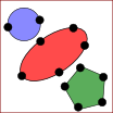
The OpenCraterTool enables a map projection-independent measurement of crater sizes as basis for accurate dating of planetary surfaces.
| Author | Thomas Heyer |
|---|---|
| Downloads | 5,677 |
| Latest version | 0.6 |
| Last updated | 2026-07-27 (81 days ago) |
| Min QGIS | 3.24.0 |
| Max QGIS | 4.99.0 |
| QGIS 4 ready | Yes |
| Maintenance | Active |
| Categories | Georeferencing & CAD, Vector tools |
| Tags | python, digitizing, vector, crater, circle |
Homepage · Repository · Issue tracker · Official page
Alternatives in Georeferencing & CAD
- Shape ToolsQGIS 4 ready
Shape Tools is a collection of geodesic shapes and tools. Create circle, ellipse, line of bearing, points along a line of bearing, concentri
- AnotherDXFImporterQGIS 4 ready
Add DXF to QGIS , optional georeferencing, optional convert DXF to Shape/GeoPackage
- LF ToolsQGIS 4 ready
Comprehensive solutions for cartographic production, surveying, drone mapping, GNSS data import, geospatial database management, digital ima



Related plugins
- QADNot QGIS 4 ready
Quantum Aided Design: cad like commands in QGIS
- Geometry ShapesQGIS 4 ready
This plugin draws basic geometry shapes (primitives) with user defined measurements
- Land Survey Codes ImportNot QGIS 4 ready
This plugin allows you to easily import data from a land survey (GPS or total station) to draw automatically in a database using a codificat
- ArcheoCADNot QGIS 4 ready
Generates a vectorial layer of Polygons, Rectangles, Circles and Ellipses using vertices.
- SecQueryNot QGIS 4 ready
Render geodesic buffers with 4-32 sectors and query the point data in them.
- Minimum Bounding BoxNot QGIS 4 ready
Create layer with extents(minx,miny, maxx, maxy) and extents geometry.





Maintenance: Active = updated within 1 year, Quiet = 1–3 years, Likely abandoned = over 3 years.