
Home › Vector tools › Minimum Bounding Box
Minimum Bounding Box QGIS 4 compatibility
Not QGIS 4 ready Active
Not yet — the latest version declares max QGIS version 3.99.0, so it is not offered to QGIS 4 users.
Create layer with extents(minx,miny, maxx, maxy) and extents geometry.
About
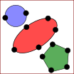
Creates minimum bounding geometries (box, oriented rectangle, circle, convex hull) with optional grouping. You will be able to create a Bounding Box Geometry for each polygon from polygons layer, create new layer with bounding boxes as thier geometries. You will also get minx, miny, maxx, maxy, and extent column conveniently.
| Author | Abdishakur |
|---|---|
| Downloads | 1,771 |
| Latest version | 1.2 |
| Last updated | 2026-02-02 (256 days ago) |
| Min QGIS | 3.0.0 |
| Max QGIS | 3.99.0 |
| QGIS 4 ready | No |
| Maintenance | Active |
| Category | Vector tools |
| Tags | convex hull, extent, maxx, oriented rectangle, minx, miny, maxy., circle, bounding box, python, polygon |
Homepage · Repository · Issue tracker · Official page
Alternatives in Vector tools
- HCMGISQGIS 4 ready
HCMGIS - Basemaps, Download OpenData, Batch Converter, VN-2000 Projections, and Field Calculation Utilities
- mmqgisQGIS 4 ready
A collection of QGIS vector layer operation plugins
- Shape ToolsQGIS 4 ready
Shape Tools is a collection of geodesic shapes and tools. Create circle, ellipse, line of bearing, points along a line of bearing, concentri


Related plugins
- BoundingBoxNot QGIS 4 ready
This plugin returns the xmin, ymin, xmax, ymax of the current view window, and the GetMap request of the selected WMS.
- Clip2PlaceQGIS 4 ready
Clip vector layers to an extent centered on a place anywhere in the world - a rectangle or circle around a point settlement (city, town, vil
- QADNot QGIS 4 ready
Quantum Aided Design: cad like commands in QGIS
- ArcheoCADNot QGIS 4 ready
Generates a vectorial layer of Polygons, Rectangles, Circles and Ellipses using vertices.
- Land Survey Codes ImportNot QGIS 4 ready
This plugin allows you to easily import data from a land survey (GPS or total station) to draw automatically in a database using a codificat
- GeoMarkQGIS 4 ready
Create named points, lines, polygons, rectangles, and circles on the map canvas with styling, coordinates, labels, and CSV import/export sup




Maintenance: Active = updated within 1 year, Quiet = 1–3 years, Likely abandoned = over 3 years.