
Home › Hydrology & water › Geology tools

Geology tools QGIS 4 compatibility
QGIS 4 ready Active
Yes — Geology tools supports QGIS 4 (declared max version 4.99.0).
Geology Tools offers a collection of plugins that simplify workflows in geology, hydrogeology, and seismic microzonation
About
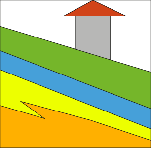
The following is a summary of the main modules and their functionalities: GEOLOGY MAPPING 1. The Geology from points and lines Tool automates the creation of geological maps. - Workflow: The user draws geological contact lines to form closed polygons and places points with geological attributes (formation codes, lithology, etc.) inside them. - Automation: The algorithm cleans duplicate geometries, creates polygons from the line network, and transfers the attributes from the points to the resulting polygons. - Output: Produces topologically clean geological polygons and contact lines ready for GIS analysis. HYDROLOGY 2. The Hydrological Analysis Stream Network (HASN) Module utilizes an integrated approach, leveraging GRASS GIS and SAGA GIS algorithms for robust watershed analysis. - Terrain Correction: It uses the Wang & Liu algorithm to fill sinks in Digital Terrain Models (DTM), ensuring a hydrologically correct surface. - Flow & Indices: It calculates drainage directions and flow accumulation to derive the Topographic Wetness Index (TWI), which identifies areas prone to saturation and runoff - Stream Delineation: The tool generates a vector stream network from the DTM, offering both a raw version for analysis and a "smooth" version for better cartographic visualization. SEISMIC MICROZONATION This section includes tools for evaluating ground stability and seismic risk: 3. Lateral Spreading Analysis (LSA): Identifies horizontal soil movement risks during earthquakes by crossing the Liquefaction Index (IL)with terrain slope percentages. It classifies areas into Respect Zones (RZ), Susceptibility Zones (SZ), or Low Susceptibility Zones (Z0). 4. Seismic Microzonazion Morphological Analysis (SMMA): Identifies areas with slopes > 15° within seismic zones. This is critical because steep morphological gradients can amplify seismic waves and increase the risk of seismic-caused landslides.
| Author | Giuseppe Cosentino (Pino), Francesco Pennica |
|---|---|
| Downloads | 6,288 |
| Latest version | 2.0.3 |
| Last updated | 2026-04-07 (192 days ago) |
| Min QGIS | 3.16.0 |
| Max QGIS | 4.99.0 |
| QGIS 4 ready | Yes |
| Maintenance | Active |
| Categories | Hydrology & water, Vector tools |
| Tags | geology, hydrology, geoprocessing, python, seismic microzonation |
Homepage · Repository · Issue tracker · Official page
Alternatives in Hydrology & water
- CrayfishQGIS 4 ready
Tools for mesh layers QGIS
- ArcGeek CalculatorQGIS 4 ready
ArcGeek Calculator is a QGIS plugin that provides a comprehensive set of tools for coordinate calculations, conversions, spatial operations,
- TUFLOWQGIS 4 ready
A collection of utilities for TUFLOW flood and coastal simulation in QGIS



Related plugins
- Lateral spreadingQGIS 4 ready
Lateral spreading for seismic microzonation
- Hydrological Analysis Stream NetworkQGIS 4 ready
Algorithm for hydrological analysis that generates the drainage network from a digital terrain model (DTM)
- MzS ToolsQGIS 4 ready
Plugin for Italian seismic microzonation.
- Seismic microzones with morphological gradientQGIS 4 ready
This DTM-based plugin provides a critical territorial screening tool. By intersecting slope gradients (≥ 15°) with seismic microzonation dat
- Geology from points and linesQGIS 4 ready
Automated Geological Mapping Plugin
- Isoliner - грид и изолинииQGIS 4 ready
2D kriging (GSLIB KB2D) and isoline / contour-polygon generation in QGIS. Кригинг 2D (GSLIB KB2D) и построение изолиний/контурных полигонов




Maintenance: Active = updated within 1 year, Quiet = 1–3 years, Likely abandoned = over 3 years.