Home › Categories › Georeferencing & CAD › Page 6
Georeferencing & CAD QGIS plugins Page 6 of 7
QGIS plugins to georeference, digitise and exchange CAD and survey data. 362 plugins, 145 QGIS 4 ready, 263 actively maintained. Sorted by downloads. Showing 301–360.
Related categories: Vector tools · Raster & terrain · Coordinates & projections · Spatial analysis · Field data & mobile · All categories
- WebODM Precisa AgrimensuraNot QGIS 4 ready
WebODM integration: drone image upload, photogrammetric processing monitoring, GCP editor, and product download (orthomosaic, DSM, DTM, poin
- Acotación de parcela GISNot QGIS 4 ready
Automatically creates persistent parcel dimensions, recognizes approximated circular arcs, and produces numbered vertices, coordinate tables
- Horizon ProjectorNot QGIS 4 ready
Horizon Projector is a complete plugin for nautical and geodetic calculations in QGIS.
- Canva FocusNot QGIS 4 ready
Plugin to view and control the focus in the central area of the map.
- EarthWorkQQGIS 4 ready
Earthwork quantities for sites and road corridors: weighted grid integration and end-area sections, void-ratio volume conversion, daylighted
- Gerador de MemoriaisNot QGIS 4 ready
Generates a georeferenced descriptive report from narrative text, a QGIS layer, or a SIGEF/INCRA PDF, including points and a polygon.
- Hatt2GreekGridNot QGIS 4 ready
Georeference scanned Hatt-projection topographic diagrams and maps (small or large sheets) and transform them to the current Greek Grid / GG
- Parcel Annotation ProNot QGIS 4 ready
Automatically annotate parcel polygons with side lengths, area, perimeter, bearings, azimuths, vertex numbers and parcel information. Built
- Poprawka odwzorowawczaQGIS 4 ready
PL: Oblicza pole działek z poprawką PL-2000 według polskich przepisów geodezyjnych. | EN: Calculates parcel areas with the statutory PL-2000
- Editor Bidang dan AtributNot QGIS 4 ready
A complete cadastral digitizing toolkit for QGIS — geometry, attribute, cadastral, and topology tools in one bundle.
- QRADEQGIS 4 ready
Rockfall risk assessment plugin based on the IMIRILAND method
- AutoGR BridgeNot QGIS 4 ready
Launch AutoGR-SIFT from QGIS and automatically import georeferenced results.
- Map Extent QRQGIS 4 ready
Generate QR codes containing the geographic extent of a QGIS Print Layout and georeference exported map images by reading the QR code embedd
- Explorador NPNNot QGIS 4 ready
Desagrega el valor de NPN (Número Predial Nacional) de una columna al pasar el mouse por la geometría de la capa elegida. Separates the Col
- npn asignacionNot QGIS 4 ready
Asigna codigos Terreno (0001-9999) NPN(Número Predial Nacional) usando diversas estrategias. / Assign Land Codes (0001-9999) for NPN (Colo
- AIVE ATLAS GEOQGIS 4 ready
Automatically georeference aerial images from drones and aircraft without placing control points manually - process one image or batches of
- Scratch-XQGIS 4 ready
Fast, lightweight scratch geometry creation tool for QGIS
- NPN DecoderQGIS 4 ready
Sistema de Inteligencia Territorial y Auditoría Catastral para la deconstrucción, validación masiva del NPN (22/30 dígitos) e integración en
- ROI BrushNot QGIS 4 ready
A pixel-aware paint brush-like tool for ROI creation over rasters.
- MJ_GeoreferencerNot QGIS 4 ready
Live GCP georeferencing tool inside QGIS main window
- IsoParcelNot QGIS 4 ready
Equitable polygon subdivision into configurable row*column grids with automatic topological cleaning.
- AutoNum ParcellesNot QGIS 4 ready
Automatically numbers cadastral parcels in nearest-neighbor order, starting from the northwesternmost parcel.
- CAD Text ExtractorNot QGIS 4 ready
CAD Text Extractor exports selected attribute fields as CAD text and source geometries into a CAD-compatible DXF output.
- Parcel Record MatcherNot QGIS 4 ready
Match tabular parcel records to cadastral polygons and generate derived points, approximate subdivision polygons, and a match report.
- PickShiftQGIS 4 ready
PickShift: Monte-Carlo estimation of positional and area uncertainty of polygons from GCP planimetric biases.
- MSA: CurveMasterNot QGIS 4 ready
CAD tool for interactive curve adjustment, fillet rounding, Trim/Extend, dynamic offset, Polar Tracking, and CAD Smart Pour/Erase pavement f
- Ochave CurvoQGIS 4 ready
Creates a 5-meter curved chamfer directly in QGIS for urban cadastre, cadastral mapping, and georeferenced lot design.
- Kiểm tra CSDL GISQGIS 4 ready
Kiểm tra hồ sơ GIS quy hoạch đô thị và nông thôn theo Thông tư 16/2025/TT-BXD (Phụ lục II): cấu trúc hồ sơ, nhóm dữ liệu chuyên đề, lớp dữ l
- CopyFromQgis - Copia QGIS a AutoCAD | GeoCAD SolutionsNot QGIS 4 ready
Copy polygons from QGIS to AutoCAD 2014-2026 in 1 click, no DXF
- Point Shift TrackerQGIS 4 ready
Track how far a point feature has been moved during editing, with live distance analysis and an in-panel warning when a shift exceeds your c
- Historical Image GeoreferencerNot QGIS 4 ready
Georeference historical imagery with interactive GCPs, live preview, GeoTIFF export, and direct PostGIS Raster upload.
- MJ-AutoAttributesNot QGIS 4 ready
Automatically fill raster name and fixed attributes during feature digitization
- Recalculo RTK a Coordenadas AjustadasQGIS 4 ready
Recalculates field points collected against a "free" RTK base to the base's adjusted coordinates from static GNSS post-processing (plane and
- Gerador de PontosNot QGIS 4 ready
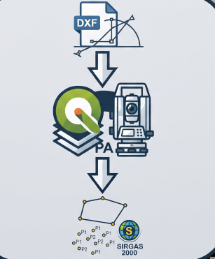
Generates staking-out points from DXF geometries (lines and arcs) in SIRGAS 2000 coordinates with millimeter precision.
- Precisa — Altitude Geoidal (hgeoHNOR2020)Not QGIS 4 ready
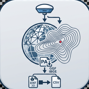
Geoid undulation and normal height via IBGE's hgeoHNOR2020 grid (BRAZIL). Automatic offline download (~2 MB), bilinear interpolation, CSV an
- Auto House NumberingNot QGIS 4 ready
Automated road-relative house numbering for selected plots/building footprints.
- Precisa PerímetroNot QGIS 4 ready
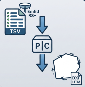
Reconstructs a boundary from Emlid RS+ TSV points (GTopo post-processed): detects chains, resolves duplicates, orders vertices and exports U
- Palm Gap DetectorQGIS 4 ready
Detect probable missing oil palm positions from georeferenced palm points by analyzing real planting rows and spacing gaps.
- PrintLayout_By_DPMJNot QGIS 4 ready
Calculate chainage values for point features along selected line layers
- PasteFromCad - Pega de AutoCAD a QGIS | GeoCAD SolutionsNot QGIS 4 ready
Paste AutoCAD entities (Ctrl+C) directly into QGIS. No DXF needed, supports 2014-2026
- Parcel-o-ramaNot QGIS 4 ready
Split parcels by area: parallel, perpendicular or pivoting cuts, equal parts, percentages, strips and boundary adjustment. / División de par
- Pluma Gaussiana EducativaNot QGIS 4 ready
Educational single- and multiple-source Gaussian plume simulations with georeferenced outputs and wind observations.
- QGDB Provider & Manager (LADM-COL Colombia)Not QGIS 4 ready
Native hierarchical geodatabase provider QGDB (extended GeoPackage) compliant with Colombia LADM-COL v3.0, IGAC Cartography, and ESRI FileGD
- Dimension ToolNot QGIS 4 ready
CAD/ArcGIS-Pro-style dimension lines (linear, aligned, angular, radius, diameter, leader) stored as a GeoPackage layer.
- RoutelinerQGIS 4 ready
Route events and CIS chainage (pikets): point and line events, ledger with station equations, reverse locating, longitudinal profiles
- SIRI CRNot QGIS 4 ready
Loads the Costa Rican cadastre WMS layers (SIRI / Registro Inmobiliario) in one click -no manual connection setup- and identifies each parce
- GeoCad UAV ToolkitQGIS 4 ready
Technical suite for forestry design and UAV photogrammetry: parametric CAD with automatic Italian cadastral lookup, reforestation planning o
- Raster ScribeQGIS 4 ready
Interactively trace lines in RGB raster maps with live previews, color sampling, and snapping.
- Spatial Format ConverterNot QGIS 4 ready
Convert polygon data among SHP, KML, KMZ, and supported CAD sources with CRS and attribute controls.
- Consulta SICARNot QGIS 4 ready
Query Brazilian SICAR/CAR rural properties by registry code or map area and add boundaries plus thematic layers to QGIS.
- Overlap ReportNot QGIS 4 ready
Overlap Report helps identify self-overlaps and intersections between polygon layers quickly and accurately, improving spatial-data validati
- Building Change to CADNot QGIS 4 ready
Automated building change detection from satellite imagery to CAD layers
- Building Road Overlap ValidatorNot QGIS 4 ready
Automated detection and correction of road-building polygon overlaps: trimming, shifting, and purging.
- Quick FeaturesQGIS 4 ready
Use feature templates and keyboard shortcuts to accelerate the manual creation of features
- Multipoint Line NamingNot QGIS 4 ready
Automates hierarchical graph-based naming for network line segments connecting origin points and secondary nodes.
- Snap Nodes CircleNot QGIS 4 ready
Snaps together all nodes located inside an adjustable circle centred on a snapping point.
- Parcel GPS – Cadastral parcels of EuropeQGIS 4 ready
Official cadastral parcels from 29 European countries as polygon layers: by cadastral reference, by clicking on the map, or in batch from a
- NLSC地籍資訊查詢QGIS 4 ready
Query Taiwan NLSC cadastral information, locate and color parcels, and generate merged boundary vectors.
- Sustituir geometría mediante dos clicsNot QGIS 4 ready
Copies the geometry of a second clicked vector feature, such as a parcel, onto a first clicked feature while preserving its attributes and i
- ParcelForgeNot QGIS 4 ready
Build polygons from DXF boundary lines and transfer DXF text into up to ten polygon attributes.