
Home › Georeferencing & CAD › Gerador de Memoriais

Gerador de Memoriais QGIS 4 compatibility
Not QGIS 4 ready Active
Not yet — the latest version declares max QGIS version 3.99.0, so it is not offered to QGIS 4 users.
Generates a georeferenced descriptive report from narrative text, a QGIS layer, or a SIGEF/INCRA PDF, including points and a polygon.
About
Gera memorial descritivo georreferenciado a partir de texto narrativo, camada QGIS ou PDF do SIGEF/INCRA, com pontos e polígono. Três modos de entrada em um só plugin: (1) Texto — cole ou carregue um memorial descritivo narrativo já pronto e gere pontos + polígono; (2) Camada QGIS — selecione uma camada de polígono em CRS UTM e gere o memorial descritivo georreferenciado em DOCX; (3) SIGEF — leia o PDF oficial do SIGEF/INCRA e gere memorial em DOCX, pontos e polígono. Declara automaticamente o sistema de cálculo com base no CRS. Todo trecho do perímetro é descrito como reta simples entre vértices (sem detecção de arco/curva). Não inclui classificação automática de confrontantes (frente/fundos/laterais) — disponível nos produtos DANI e GEO RURAL.
| Author | Helton J. C. Lourenço |
|---|---|
| Downloads | 401 |
| Latest version | 1.5 |
| Last updated | 2026-09-24 (22 days ago) |
| Min QGIS | 3.16.0 |
| Max QGIS | 3.99.0 |
| QGIS 4 ready | No |
| Maintenance | Active |
| Category | Georeferencing & CAD |
| Tags | perímetro, agrimensura, georreferenciamento, topografia, restituição, incra, sigef, azimute, memorial descritivo |
Homepage · Repository · Issue tracker · Official page
Alternatives in Georeferencing & CAD
- Shape ToolsQGIS 4 ready
Shape Tools is a collection of geodesic shapes and tools. Create circle, ellipse, line of bearing, points along a line of bearing, concentri
- AnotherDXFImporterQGIS 4 ready
Add DXF to QGIS , optional georeferencing, optional convert DXF to Shape/GeoPackage
- LF ToolsQGIS 4 ready
Comprehensive solutions for cartographic production, surveying, drone mapping, GNSS data import, geospatial database management, digital ima



Related plugins
- MRF Translado GNSSQGIS 4 ready
Professional QGIS plugin for GNSS coordinate translation with integrated map visualization, PPP IBGE and SIGEF Memorial support, variance pr
- Coleta RuralNot QGIS 4 ready
Imports Coleta Rural PDF survey reports and other memorial descritivo formats (any Brazilian state), automatically creating polygon features
- GeoINCRAQGIS 4 ready
Georeferencing of rural properties according to INCRA’s Brazilian technical regulations for land regularization.
- GeoRondôniaQGIS 4 ready
Tools for Georeferencing Rural Properties
- Precisa PerímetroNot QGIS 4 ready
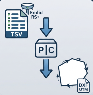
Reconstructs a boundary from Emlid RS+ TSV points (GTopo post-processed): detects chains, resolves duplicates, orders vertices and exports U
- Precisa — CotasNot QGIS 4 ready
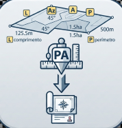
Generates length, azimuth, area and perimeter labels rotated along vector feature segments.




Maintenance: Active = updated within 1 year, Quiet = 1–3 years, Likely abandoned = over 3 years.