
Home › Georeferencing & CAD › GeoINCRA

GeoINCRA QGIS 4 compatibility
QGIS 4 ready Active
Yes — GeoINCRA supports QGIS 4 (declared max version 4.99.0).
Georeferencing of rural properties according to INCRA’s Brazilian technical regulations for land regularization.
About
Tools designed to support the georeferencing of rural land parcels in Brazil, following the technical standards of the National Institute for Colonization and Agrarian Reform (INCRA). The plugin is widely used in processes of rural land regularization and cadastral compliance. 🌎🇧🇷 Ferramentas desenvolvidas para apoiar o georreferenciamento de imóveis rurais no Brasil, conforme as normas técnicas do Instituto Nacional de Colonização e Reforma Agrária (INCRA). O plugin é amplamente utilizado em processos de regularização fundiária e conformidade cadastral.
| Author | Tiago Prudencio, Leandro França |
|---|---|
| Downloads | 165,070 |
| Latest version | 2.0.4 |
| Last updated | 2026-06-14 (123 days ago) |
| Min QGIS | 3.40.0 |
| Max QGIS | 4.99.0 |
| QGIS 4 ready | Yes |
| Maintenance | Active |
| Category | Georeferencing & CAD |
| Tags | georreferenciamento, imoveis, rurais, incra, sigef, planilha, ods, brazil, georural, geoone |
Homepage · Repository · Issue tracker · Official page
Alternatives in Georeferencing & CAD
- Shape ToolsQGIS 4 ready
Shape Tools is a collection of geodesic shapes and tools. Create circle, ellipse, line of bearing, points along a line of bearing, concentri
- AnotherDXFImporterQGIS 4 ready
Add DXF to QGIS , optional georeferencing, optional convert DXF to Shape/GeoPackage
- LF ToolsQGIS 4 ready
Comprehensive solutions for cartographic production, surveying, drone mapping, GNSS data import, geospatial database management, digital ima



Related plugins
- GeoRondôniaQGIS 4 ready
Tools for Georeferencing Rural Properties
- GeoCARQGIS 4 ready
Ferramentas para preparação, análise e exportação de dados do Cadastro Ambiental Rural (CAR) no QGIS | Tools for preparing, analyzing and ex
- MRF Translado GNSSQGIS 4 ready
Professional QGIS plugin for GNSS coordinate translation with integrated map visualization, PPP IBGE and SIGEF Memorial support, variance pr
- Gerador de MemoriaisNot QGIS 4 ready
Generates a georeferenced descriptive report from narrative text, a QGIS layer, or a SIGEF/INCRA PDF, including points and a polygon.
- Precisa PerímetroNot QGIS 4 ready
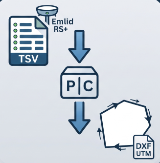
Reconstructs a boundary from Emlid RS+ TSV points (GTopo post-processed): detects chains, resolves duplicates, orders vertices and exports U
- GeoDocs SIGEFNot QGIS 4 ready
Automated generation of technical documents for SIGEF/INCRA rural land regularization workflows.





Maintenance: Active = updated within 1 year, Quiet = 1–3 years, Likely abandoned = over 3 years.