
Home › Vector tools › Coleta Rural

Coleta Rural QGIS 4 compatibility
Not QGIS 4 ready Active
Not yet — the latest version declares max QGIS version 3.99.0, so it is not offered to QGIS 4 users.
Imports Coleta Rural PDF survey reports and other memorial descritivo formats (any Brazilian state), automatically creating polygon features in QGIS vector layers — and generates memorial descritivo PDF reports from selected polygons, recognizing SIGEF/CAR public layers.
About
Plugin developed by Dihêgo Augusto Gomes Malvim de Barros, Technical Assistant for Land Governance at INCRA Pernambuco. It automatically imports Coleta Rural PDF survey reports from any Brazilian state (or memoriais descritivos from other sources, via text/PDF or a KML/GeoJSON/SHP/DXF geometry file), extracts parcel information and coordinates, generates polygon geometries, and saves features directly into configured QGIS vector layers. It can also generate a memorial descritivo PDF report (matching the official Coleta Rural layout, with a satellite basemap croqui) directly from one or more polygons already selected in a project layer — merging adjacent polygons into a single boundary when more than one is selected, and automatically recognizing SIGEF Brasil and CAR/SICAR public layer schemas to pre-fill CIR, Matrícula, Imóvel, Município and UF.
| Author | Dihêgo Augusto Gomes Malvim de Barros - INCRA Pernambuco |
|---|---|
| Downloads | 881 |
| Latest version | 1.2.4 |
| Last updated | 2026-10-09 (7 days ago) |
| Min QGIS | 3.28.0 |
| Max QGIS | 3.99.0 |
| QGIS 4 ready | No |
| Maintenance | Active |
| Categories | Vector tools, Georeferencing & CAD |
| Tags | cadastro rural, georreferenciamento, incra, sig, qgis, coleta rural, regularização fundiária, memorial descritivo |
Homepage · Repository · Issue tracker · Official page
Alternatives in Vector tools
- HCMGISQGIS 4 ready
HCMGIS - Basemaps, Download OpenData, Batch Converter, VN-2000 Projections, and Field Calculation Utilities
- mmqgisQGIS 4 ready
A collection of QGIS vector layer operation plugins
- Shape ToolsQGIS 4 ready
Shape Tools is a collection of geodesic shapes and tools. Create circle, ellipse, line of bearing, points along a line of bearing, concentri


Related plugins
- MRF Translado GNSSQGIS 4 ready
Professional QGIS plugin for GNSS coordinate translation with integrated map visualization, PPP IBGE and SIGEF Memorial support, variance pr
- Gerador de MemoriaisNot QGIS 4 ready
Generates a georeferenced descriptive report from narrative text, a QGIS layer, or a SIGEF/INCRA PDF, including points and a polygon.
- GeoINCRAQGIS 4 ready
Georeferencing of rural properties according to INCRA’s Brazilian technical regulations for land regularization.
- GeoRondôniaQGIS 4 ready
Tools for Georeferencing Rural Properties
- Precisa PerímetroNot QGIS 4 ready
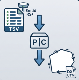
Reconstructs a boundary from Emlid RS+ TSV points (GTopo post-processed): detects chains, resolves duplicates, orders vertices and exports U
- Memorial Descritivo ImporterQGIS 4 ready
Detects and imports vertex coordinates from Brazilian land survey PDF documents (memorial descritivo) into a point layer, with automatic for





Maintenance: Active = updated within 1 year, Quiet = 1–3 years, Likely abandoned = over 3 years.