Home › Categories › LiDAR & point cloud
LiDAR & point cloud QGIS plugins
QGIS plugins to process, classify and visualise LiDAR and point cloud data. 53 plugins, 26 QGIS 4 ready, 32 actively maintained. Sorted by downloads.
Related categories: Raster & terrain · Vector tools · Remote sensing · Data download & OSM · Network & routing · All categories
Selection guide
How to choose
- Since QGIS 3.18, LAS, LAZ and COPC point clouds open natively (through PDAL), with 3D views and elevation profiles, so you may not need a plugin just to look at LiDAR.
- For processing such as ground classification, DTMs and canopy height models, LAStools adds Processing algorithms. Some of its tools are licensed for large files.
- Several national LiDAR programmes have download plugins (for example France's IGN tiles). Search for your region.
Recommended picks
- LAStoolsQGIS 4 ready
Batch point-cloud processing: classification, DTMs, tiling and conversion.
- 559,982 downloads (most in this list)
- Supports QGIS 3.2–4.99
- Last release 4 months ago (v2.4.0)
- FUSION for ProcessingQGIS 4 ready
FUSION ground filtering and surface tools (needs FUSION installed).
- 56,195 downloads
- Supports QGIS 3.0–4.99
- Last release 6 months ago (v4.0)
- LiDAR Relief VisualizationQGIS 4 ready
Relief visualisations of LiDAR terrain for archaeology.
- 5,728 downloads
- Supports QGIS 3.0–4.99
- Last release 3 months ago (v2.2.1)
- PointCloudFRQGIS 4 ready
Downloads IGN LiDAR HD tiles for an area of interest (France).
- 13,455 downloads
- Supports QGIS 3.34–4.99
- Last release 35 days ago (v2.3.1)




Before you install: AGIS is popular (64,117 downloads) but is not yet listed for QGIS 4, and its last release was 9 months ago.
Picks are chosen by hand (topped up by downloads, QGIS 4 listing and release recency where needed). The facts under each come from the QGIS plugin repository and refresh with every daily build. Picks are not sponsored.
All 53 LiDAR & point cloud plugins
- LAStoolsQGIS 4 ready
batch-scriptable, multicore command-line tools for processing point clouds in LAS, LAZ, and ASCII formats
- Pobieracz danych GUGiKQGIS 4 ready
Pozwala na pobranie danych z zasobów GUGiK z interfejsu QGIS. EN: Allows user to download spatial data of Poland based on GUGiK's services.(
- AGISNot QGIS 4 ready
Archaeological GIS, toolbox for Slovenian Archaeologists.
- Open LiDAR ToolboxNot QGIS 4 ready
Open Tools for LiDAR Data Preparation and Analysis in Archaeology
- FUSION for ProcessingQGIS 4 ready
Suite of tools for LiDAR analysis and visualisation
- Flight PlannerQGIS 4 ready
Flight Planner allows you to design photogrammetric flight. Plugin is also equipped in simple tools allowing to asses the flight project (or
- qLidarNot QGIS 4 ready
QGIS plugin to use point clouds from LIDAR or Photogrammetry
- TlugProcessingNot QGIS 4 ready
TLUBN Algorithms (is continued as ThToolBox)
- PDALtoolsNot QGIS 4 ready
Installs PDALtools Processing provider
- PointCloudFRQGIS 4 ready
Downloads LiDAR tiles from IGN that intersect with the input AOI
- qpalsNot QGIS 4 ready
OPALS software integrated into QGIS
- Illini Drainage ToolsNot QGIS 4 ready
Performs Specific Draiange Related Tasks and Analysis on a Site using a LiDAR DEM data.
- CHM from LIDARNot QGIS 4 ready
This plugin creates the Canopy Height Model (CHM) from LIDAR data (DTM and DSM First Pulse).
- Lidar ManagerNot QGIS 4 ready
Manage lidar (dtm/dsm) dataset from Tile Index Layer
- ALS DownloaderNot QGIS 4 ready
ALS data downloader for Slovenia and the Netherlands.
- qgissprpNot QGIS 4 ready
A simple photogrammetry route planner.
- LiDAR Relief VisualizationQGIS 4 ready
A free, open-source QGIS toolkit with 31 Processing algorithms for archaeological LiDAR visualization and terrain analysis. Reveal subtle ea
- T Vertical SessionsNot QGIS 4 ready
Used to Vertical Sessions of Lidar Point Cloud
- LiDARHeightExtractorQGIS 4 ready
Plugin to compute nDSM from point clouds and compute maximal height per polygon (buildings, trees...). Qt6 ready.
- Lidar CampaniaQGIS 4 ready
Import of lidar data (1x1) from the Campania region (Italy). Data are added directly from the website http://sit.cittametropolitana.na.it/
- GeoMove Processing providerNot QGIS 4 ready
Installs GeoMove models and scripts in Processing toolbox
- DataDownloaderNot QGIS 4 ready
Téléchargement de données depuis les serveurs IGN, BRGM et Copernicus
- Local Dominance VisualisationNot QGIS 4 ready
This plugin makes Local Dominance visualisations of raster images
- PV ProspectorNot QGIS 4 ready
Displays the PV installation potential for residential properties. The pv_area layer is derived from 1m LIDAR DSM, OSMM building outlines an
- Lidar Tile MakerNot QGIS 4 ready
The plugin creates a vector file containing the polygons of the tiles of a lidar campaign starting from the raster data (DSM and DTM).
- CityForgeQGIS 4 ready
CityForge is a QGIS plugin for reconstructing 3D buildings from footprint and point cloud into CityJSON files.
- FlaiQGIS 4 ready
Provides GUI access to Flai’s Open Lidar Data Hub and local control over the Flai CLI for AI-powered geospatial classification.
- SPANNot QGIS 4 ready
SPAN is a flexible and easy to use open-source plugin based on the QGIS software for rooftop mounted PV potential estimation capable of esti
- SkyDeck PluginNot QGIS 4 ready
Seamlessly Integrate and Manage SkyDeck Geospatial Data within QGIS
- TilePickNot QGIS 4 ready
Easy load raster or point cloud tiles from index vector layer or map canvas position
- Aerial LiDAR ClassifierQGIS 4 ready
Classify airborne and mobile mapping LiDAR point clouds with deep learning (LitePT-L, SegFormer 3D).
- finding_laylinesNot QGIS 4 ready
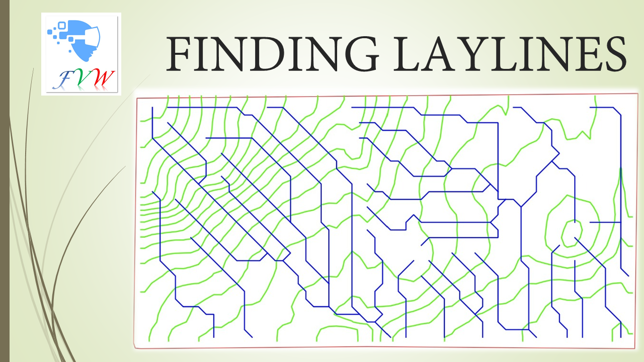
This plugin creates drain nets (consisting of contour lines and surface flow pathways called LAYLINES that are at right angles to each other
- TrailScanQGIS 4 ready
Deep learning-based segmentation of skid trails from airborne LiDAR data
- moniQueNot QGIS 4 ready
Monoplotting oblique images with uncertainty estimation.
- LAS to ENVI-met Tree ConverterQGIS 4 ready
Converts LAS/LAZ point clouds into ENVI‑met tree models with Leaf Area Density (LAD) calculation and A‑gs physiological parameterisation
- DJI RTK QAQGIS 4 ready
QA DJI RTK photo sets: plots RPT route quality, styles photos by RTK RMSE, and flags abnormal windows.
- TENGUNGUNNot QGIS 4 ready
To list up and download point cloud data such as "VIRTUAL SHIZUOKA"
- Point Cloud Filter SliderNot QGIS 4 ready
GUI panel to change values in simple query builder filter for point clouds. (Deprecated since 3.38 when functionality is built in core)
- GEDIMetricsQGIS 4 ready
Download, subset and merge GEDI products (L2A/L2B/L4A V002/V003; L4C V002) into a single GeoPackage with selectable variables and filters.
- 360ForYou UploaderQGIS 4 ready
Upload raster, vector and point cloud layers from QGIS to a 360-for-you.com project
- GeoLogic Flight PlannerQGIS 4 ready
Generates high-efficiency flight routes with terrain following, compatible with the UAV.COM API (DJI Fly).
- potreecraftNot QGIS 4 ready
A potree scene constructor GUI
- geoiQGIS 4 ready
Sign in to your geoi platform, browse your content, add your services as layers, publish or save QGIS projects, publish raster as cloud-nati
- nivaQGIS 4 ready
QGIS from the command line: write concise text-pipeline geoprocessing flows (no PyQGIS coding) and run them in a dock.
- LasBuildSegNot QGIS 4 ready
An automated building footprint extraction pipeline and Python library from LiDAR point clouds.
- Show And HideQGIS 4 ready
A simple plugin that allows you to turn visible vector, raster and point cloud layers on and off.
- Marche à l'ombreNot QGIS 4 ready
This plugin calculates for a given hike the shady and sunny parts in France
- QGIS2PotreeQGIS 4 ready
Integrates a Potree point-cloud viewer into QGIS 3 and QGIS 4 and exports portable Potree projects from LAS, LAZ and COPC layers.
- Acervo SIG - CPRMQGIS 4 ready
Catalogo do acervo GEOSGB do Servico Geologico do Brasil (SGB/CPRM) diretamente no QGIS: pesquise, baixe e adicione dados ao projeto. Catal
- Remove Temporary LayersQGIS 4 ready
Review and safely remove temporary layers (vector, raster, mesh, point cloud) from your QGIS project.
- LiDAR AutoVector StudioQGIS 4 ready
Interactive LiDAR-to-vector automation with independent extraction of water, vegetation, low vegetation, settlements, buildings, cropland, b
- LIDAR Downloader UKQGIS 4 ready
Download UK LIDAR data straight into QGIS
- RoboCOPCQGIS 4 ready
Convert GeoParquet layers to COPC (and back)