
Home › Coordinates & projections › Precisa — Cálculo Geodésico
Precisa — Cálculo Geodésico QGIS 4 compatibility
Not QGIS 4 ready Active
Not yet — the latest version declares max QGIS version 3.99.0, so it is not offered to QGIS 4 users.
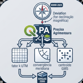
Magnetic declination (offline WMM-2025), meridian convergence, UTM scale factor, inverse azimuth and DMS conversion. Requires pyproj and geopandas.
About
Calcula: (1) declinação magnética via modelo WMM-2025 offline (pygeomag/pyproj); (2) convergência meridiana e fator k UTM para qualquer zona; (3) azimute inverso entre dois pontos; (4) conversão DD↔GMS. Usa geopandas para leitura de camadas e pyproj para projeção. Funciona também como script standalone.
| Author | Helton J. C. Lourenço |
|---|---|
| Downloads | 235 |
| Latest version | 1.5.0 |
| Last updated | 2026-08-02 (74 days ago) |
| Min QGIS | 3.16.0 |
| Max QGIS | 3.99.0 |
| QGIS 4 ready | No |
| Maintenance | Active |
| Category | Coordinates & projections |
| Tags | geodesia, utm, fator k, wmm, convergência meridiana, azimute, declinação magnética, sirgas2000 |
Homepage · Repository · Issue tracker · Official page
Alternatives in Coordinates & projections
- Lat Lon ToolsQGIS 4 ready
Tools to capture and zoom to coordinates using decimal, DMS, WKT, GeoJSON, MGRS, UTM, UPS, Geohash, H3, Maidenhead grid, Plus Codes, and ECE
- Azimuth and Distance CalculatorQGIS 4 ready
Calculates azimuths and distances for a selected feature. The feature can be either a line or a polygon. The plugin also calculates Meridian
- Usługa Lokalizacji Działek KatastralnychQGIS 4 ready
Wtyczka pozwala na pobieranie geometrii granic działek katastralnych, obrębów, gmin, powiatów i województw. ENG: The plugin made for dowload



Related plugins
- Conversor UTM para SIG-RINot QGIS 4 ready
This tool automates the conversion of coordinate files from the UTM (Universal Transverse Mercator) projected system into the standardized G
- Horizon ProjectorNot QGIS 4 ready
Horizon Projector is a complete plugin for nautical and geodetic calculations in QGIS.
- Precisa — RBMC / Efemérides / PPKNot QGIS 4 ready
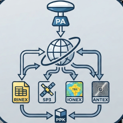
Automated download of RINEX, SP3, IONEX, ANTEX, hgeoHNOR2020 and a full PPK kit, with an optional AI co-pilot for ephemeris and RBMC (BRAZIL
- RMCGEOQGIS 4 ready
Geospatial toolkit with drawing tools (azimuth, bearing, offset, extend, chamfer), coordinate operations, and attribute table calculators.
- ProGrid QGIS — Transformador de DatumNot QGIS 4 ready
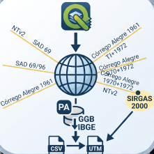
Offline coordinate transformation between SAD69, SAD69/96, Córrego Alegre 1961/1970 and SIRGAS2000 via IBGE NTv2 grids, equivalent to ProGri
- Magnetic Bearing Measurement Map ToolNot QGIS 4 ready
Measure magnetic bearing and distance between two points



Maintenance: Active = updated within 1 year, Quiet = 1–3 years, Likely abandoned = over 3 years.