
Home › Coordinates & projections › Conversor UTM para SIG-RI
Conversor UTM para SIG-RI QGIS 4 compatibility
Not QGIS 4 ready Active
Not yet — the latest version declares max QGIS version 3.99.0, so it is not offered to QGIS 4 users.
This tool automates the conversion of coordinate files from the UTM (Universal Transverse Mercator) projected system into the standardized Geographic text format (Decimal Degrees) required by the SIG-RI of the Brazilian Land Registry.
About
Plugin para o QGIS que converte coordenadas UTM para o formato geográfico do SIG-RI (lon,lat;), utilizando a lógica oficial de conversão do INPE.
| Author | Thiago Norio Santos Igarashi & Gemini |
|---|---|
| Downloads | 476 |
| Latest version | 1.0.0 |
| Last updated | 2026-07-02 (106 days ago) |
| Min QGIS | 3.0.0 |
| Max QGIS | 3.99.0 |
| QGIS 4 ready | No |
| Maintenance | Active |
| Category | Coordinates & projections |
| Tags | agrimensura, utm, topografia, lon, engenharia, sig-ri, cartório de registro de imóveis, sirgas2000, inpe, lat |
Homepage · Repository · Issue tracker · Official page
Alternatives in Coordinates & projections
- Lat Lon ToolsQGIS 4 ready
Tools to capture and zoom to coordinates using decimal, DMS, WKT, GeoJSON, MGRS, UTM, UPS, Geohash, H3, Maidenhead grid, Plus Codes, and ECE
- Azimuth and Distance CalculatorQGIS 4 ready
Calculates azimuths and distances for a selected feature. The feature can be either a line or a polygon. The plugin also calculates Meridian
- Usługa Lokalizacji Działek KatastralnychQGIS 4 ready
Wtyczka pozwala na pobieranie geometrii granic działek katastralnych, obrębów, gmin, powiatów i województw. ENG: The plugin made for dowload



Related plugins
- GeoPoint ManagerQGIS 4 ready
Creates point vector layers from data sources with coordinate fields (lat/lon). Supports OGR/GDAL URLs, Google Sheets, GeoJSON, WFS and exis
- Precisa — Cálculo GeodésicoNot QGIS 4 ready
Magnetic declination (offline WMM-2025), meridian convergence, UTM scale factor, inverse azimuth and DMS conversion. Requires pyproj and geo
- MRF Translado GNSSQGIS 4 ready
Professional QGIS plugin for GNSS coordinate translation with integrated map visualization, PPP IBGE and SIGEF Memorial support, variance pr
- Gerador de PontosNot QGIS 4 ready
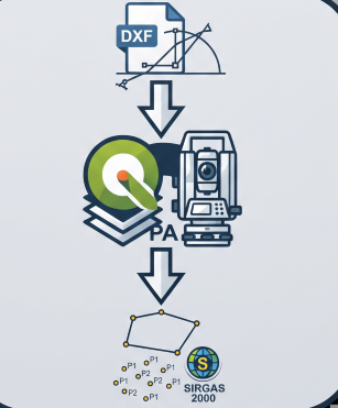
Generates staking-out points from DXF geometries (lines and arcs) in SIRGAS 2000 coordinates with millimeter precision.
- Memorial Descritivo ImporterQGIS 4 ready
Detects and imports vertex coordinates from Brazilian land survey PDF documents (memorial descritivo) into a point layer, with automatic for
- CAD Toolbar ProNot QGIS 4 ready
Toolkit CAD completo para QGIS — linha de comando estilo AutoCAD, curvas, geoprocessamento, transformações e exportação.





Maintenance: Active = updated within 1 year, Quiet = 1–3 years, Likely abandoned = over 3 years.