
Home › Network & routing › Easy-OTP

Easy-OTP QGIS 4 compatibility
Not QGIS 4 ready Active
Not yet — the latest version declares max QGIS version 3.99.0, so it is not offered to QGIS 4 users.
Automated temporal accessibility analysis using OpenTripPlanner.
About
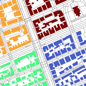
Automates temporal accessibility analysis for public transport using OpenTripPlanner 1.5.0. Generates per-minute travel-time surfaces, counts continuous service-time minutes per hexagonal grid cell, and classifies cells into four categories. Analysis algorithms: RunTemporalAccessibility (depart-at and arrive-by modes, optional XLSX report), CountFromExistingSurfaces, CompareTemporalAccessibility (delta analysis), GenerateHexGrid, PrepareStudentLayer, PopulationOverlay, GenerateIsochrones (isochrone polygons from/to 1..N points, one time, multiple cutoffs), GenerateIsochronesOverTime (one point, isochrones across the day for the Temporal Controller), RunServiceCoverage (count of service points reachable per cell within a threshold at one time; raster + optional grid), RunOriginDestinationTimes (per-origin trip stats to one destination: duration, in-vehicle, walk, wait, transfers; parallelised), RunTravelTimeMatrix (N×M origin–destination travel-time matrix), RouteViaPoints (city tour planner: ordered route through optional via-points using nearest-neighbour + 2-opt; modes: WALK, BICYCLE, CAR, TRANSIT,WALK). Realtime algorithms: RunRealtimeAccessibility (RT-1, live GTFS-RT feed integrated into OTP), RecordGtfsRt (RT-2, GTFS-RT TripUpdates archiver for offline analysis), BuildRealizedGtfs (RT-3, reconstructs a realized static GTFS — P50 median and P85 85th-percentile feeds — from a RecordGtfsRt snapshot archive; output feeds can be passed directly to RunTemporalAccessibility; requires google.protobuf bootstrapped on first use; v0.7 adds auto-detected MATCHING_MODE and SEGMENT_SOURCE_MODE fallbacks for feeds whose trip_id namespace or message shape differs from Gdańsk's, e.g. Poznań/Kraków). Setup: DownloadJre (Eclipse Temurin 8 + OTP 1.5.0 jar, SHA-256 verified), DownloadTransitData (Geofabrik OSM + Transitland GTFS), TestOtpServer.
| Author | Michal Kaczorowski |
|---|---|
| Downloads | 967 |
| Latest version | 0.7.0 |
| Last updated | 2026-08-06 (71 days ago) |
| Min QGIS | 3.22.0 |
| Max QGIS | 3.99.0 |
| QGIS 4 ready | No |
| Maintenance | Active |
| Category | Network & routing |
| Tags | jre, java, travel time, transit, public transport, population, accessibility, isochrone, opentripplanner, gtfs, otp |
Homepage · Repository · Issue tracker · Official page
Alternatives in Network & routing
- ORS ToolsQGIS 4 ready
openrouteservice routing, isochrones and matrix calculations for QGIS
- NetworksQGIS 4 ready
Designed as a processing algorithm provider. Manage linear networks and compute multimodal routing and accessibility. Several functionalitie
- TravelTime PluginQGIS 4 ready
Get travel time polygons from the TravelTime API directly from QGIS


Related plugins
- Easy-R5Not QGIS 4 ready
Transit accessibility analysis with the Conveyal R5 routing engine.
- Transit Reachability AnalyserNot QGIS 4 ready
Using OpenTripPlanner to calculate public transport reachability from a starting point to all stops in a GTFS feed.
- 02Route 3D - Multi-Criteria 3D Mobility StudioQGIS 4 ready
3D routing and urban mobility analysis for 15 user profiles (wheelchair, senior, child, bicycle, scooter, car, truck...): slope-aware shorte
- Service Access MapperNot QGIS 4 ready
Generate travel-time catchments (isochrones) to services using road networks, estimate population coverage using WorldPop data, and summariz
- GtfsShapesCreatorNot QGIS 4 ready
Generates GTFS shapes.txt files by routing transit lines on OpenStreetMap road and rail networks, with current support for opentransportdata
- LOOM Transit Map GeneratorQGIS 4 ready
Generate schematic and geographically accurate transit maps using the LOOM suite, directly inside QGIS. No command-line knowledge required.




Maintenance: Active = updated within 1 year, Quiet = 1–3 years, Likely abandoned = over 3 years.