
Home › Network & routing › Disconnected Islands

Disconnected Islands QGIS 4 compatibility
QGIS 4 ready Active
Yes — Disconnected Islands supports QGIS 4 (declared max version 4.99.0).
Finds disconnected "islands" in a transport network layer, so that a routing tool will work between all nodes. A tolerance field allows for imperfect topology. Now supports options for vertices.
About
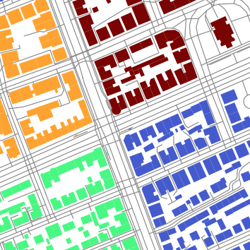
This plugin runs on a polyline layer, building up a road (or rail, etc.) network graph of connected links. It then analyses connected subgraphs, ones that are connected to each other, but not connected to isolated or floating links. It creates an additional attribute containing the group ID of the subgraph. This can then be used to style the layer with Categorised styles, or Zoom to selection. The disconnected links can then be fixed. <br/> Version 2.1.0 introduces a new option to only use the start and end vertices of a road link (previously all vertices were considered.) A group ID of -1 (hidden) indicates a second road link with exactly the same start and end vertices as another road link, but probably with different in-between vertices. <br/> Based on Detlev's answer to my question: http://gis.stackexchange.com/questions/184319/how-to-find-disconnected-islands-in-a-road-network-layer-using-qgis <br/> Sample data to test this plugin can be found: - in your plugins directory: ...QGIS/QGIS3/profiles/default/python/plugins/disconnected-islands/sample-data/islands.zip - via GitHub: https://github.com/AfriGIS-South-Africa/disconnected-islands/raw/master/sample-data/islands.zip<br/> This plugin depends on the NetworkX module. Mac OS X users need to install it manually, simply by executing, in a Terminal: sudo easy_install networkx. Then restart QGIS.
| Author | Peter Smythe @ AfriGIS |
|---|---|
| Downloads | 39,683 |
| Latest version | 2.2.0 |
| Last updated | 2026-06-03 (135 days ago) |
| Min QGIS | 3.0.0 |
| Max QGIS | 4.99.0 |
| QGIS 4 ready | Yes |
| Maintenance | Active |
| Category | Network & routing |
| Tags | network analysis, routing, network, polyline, topography, analysis, processing |
Homepage · Repository · Issue tracker · Official page
Alternatives in Network & routing
- ORS ToolsQGIS 4 ready
openrouteservice routing, isochrones and matrix calculations for QGIS
- NetworksQGIS 4 ready
Designed as a processing algorithm provider. Manage linear networks and compute multimodal routing and accessibility. Several functionalitie
- TravelTime PluginQGIS 4 ready
Get travel time polygons from the TravelTime API directly from QGIS


Related plugins
- Short PathNot QGIS 4 ready
Find shortest path between points based on line (network) layer.
- QRouteCodeQGIS 4 ready
Converts vector lines and polylines into scannable Google Maps routing QR codes for mobile navigation.
- Area Along VectorNot QGIS 4 ready
Create an area along a vector depending on a field value. Right and left sides can be distinguished.
- pgRoutingLayerNot QGIS 4 ready
Dockable widget that adds pgRouting layers
- Chinese Postman SolverNot QGIS 4 ready
Chinese Postman Solver
- Transit Reachability AnalyserNot QGIS 4 ready
Using OpenTripPlanner to calculate public transport reachability from a starting point to all stops in a GTFS feed.





Maintenance: Active = updated within 1 year, Quiet = 1–3 years, Likely abandoned = over 3 years.