
Home › Georeferencing & CAD › Align Features to Path
Align Features to Path QGIS 4 compatibility
QGIS 4 ready Active
Yes — Align Features to Path supports QGIS 4 (declared max version 4.99.0).
Snap and align polygon/line features to a digitised alignment path with gap-free shared boundaries (Global Master Path Snapping).
About
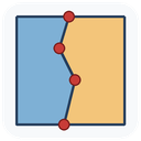
Draw an alignment path on the map, then align nearby polygon or line features to it using one of two methods: Fit to Path (near-path edges are densified and traced onto the path) or Preserve Shape (only vertices inside the tolerance zone move). v11 introduces Global Master Path Snapping: every aligned vertex is quantised to a single canonical master vertex list derived from the drawn path, so adjacent features receive bitwise-identical shared-boundary coordinates — zero gaps or slivers by construction. Tolerance is a hard boundary: only features intersecting the tolerance buffer are touched and only vertices within tolerance move.
| Author | Mustafa Elghazaly |
|---|---|
| Downloads | 1,767 |
| Latest version | 14.7.6 |
| Last updated | 2026-10-01 (15 days ago) |
| Min QGIS | 3.16.0 |
| Max QGIS | 4.99.0 |
| QGIS 4 ready | Yes |
| Maintenance | Active |
| Categories | Georeferencing & CAD, Vector tools |
| Tags | cadastral, qgis4, topology, curve, polygon, trace, snap, alignment |
Homepage · Repository · Issue tracker · Official page
Alternatives in Georeferencing & CAD
- Shape ToolsQGIS 4 ready
Shape Tools is a collection of geodesic shapes and tools. Create circle, ellipse, line of bearing, points along a line of bearing, concentri
- AnotherDXFImporterQGIS 4 ready
Add DXF to QGIS , optional georeferencing, optional convert DXF to Shape/GeoPackage
- LF ToolsQGIS 4 ready
Comprehensive solutions for cartographic production, surveying, drone mapping, GNSS data import, geospatial database management, digital ima



Related plugins
- brdrQQGIS 4 ready
brdrQ – Automatically align and correct geometries (points, lines, polygons) using reference boundaries. brdrQ proposes aligned geometries i
- TopolinerQGIS 4 ready
Topology check, cleanup and coverage model for polygon and line layers: snapping, missing nodes, dangles and overshoots, assembly check, top
- NetworkGTNot QGIS 4 ready
NetworkGT (Network Geometry and Topology) Toolbox is a set of tools designed for the geometric and topological analysis of fracture networks
- タイル境界道路接続QGIS 4 ready
タイル境界で分断された道路の接続を自動修復。Fix tile-cut road connectivity by snapping endpoints near tile boundaries.
- TopoTidyNot QGIS 4 ready
Turn messy vector data into clean topology in QGIS: cleanup tools (snap, trim, extend, split, dissolve, fix geometry, simplify, remove dupli
- Network TopologyQGIS 4 ready
Toolkit to clean and build the topology of line networks (roads, rivers, pipelines, railways).




Maintenance: Active = updated within 1 year, Quiet = 1–3 years, Likely abandoned = over 3 years.