
Home › Remote sensing › SateAIs API for QGIS

SateAIs API for QGIS QGIS 4 compatibility
QGIS 4 ready Active
Yes — SateAIs API for QGIS supports QGIS 4 (declared max version 4.99.0).
Run SateAIs SAR satellite detection (ship, oil slick, new building, disappear building, time series) directly from QGIS.
About
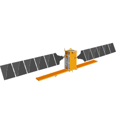
SateAIs is a SAR satellite image analysis platform (currently supporting Sentinel-1). This plugin lets GIS users invoke detection jobs from QGIS, view results as map layers, and manage jobs without leaving the QGIS environment. Requires a SateAIs API key from https://console.spcsft.com.
| Author | SpaceShift Inc. |
|---|---|
| Downloads | 738 |
| Latest version | 0.4.1 |
| Last updated | 2026-09-14 (32 days ago) |
| Min QGIS | 3.34.0 |
| Max QGIS | 4.99.0 |
| QGIS 4 ready | Yes |
| Maintenance | Active |
| Category | Remote sensing |
| Tags | remote sensing, change detection, building detection, sar, satellite, ship detection, sateais, oil slick, sentinel-1 |
Homepage · Repository · Issue tracker · Official page
Alternatives in Remote sensing
- Semi-Automatic Classification PluginQGIS 4 ready
The Semi-Automatic Classification Plugin (SCP) allows for the supervised classification of remote sensing images, providing tools for the do
- Google Earth EngineQGIS 4 ready
Integrates QGIS with Google Earth Engine
Raster classification in QGIS with 11 machine learning algorithms, Optuna hyperparameter search, SHAP explanations, class imbalance handling



Related plugins
- InSAR ExplorerQGIS 4 ready
InSAR Explorer is a QGIS plugin for interactive visualization and analysis of InSAR time-series data.
- AGLgisQGIS 4 ready
Sentinel-1 SAR (VV/VH) backscatter time series and analysis-ready data preparation in Google Earth Engine — cloud-independent / Séries tempo
- FARM toolsQGIS 4 ready
Toolbox of geo-analytics modules for research, education, agriculture, and land monitoring: vegetation index time series, multispectral/SAR/
- InSAR SuiteQGIS 4 ready
Integrated suite for loading, processing and analysis of PSI displacement data
- SAR VIEWNot QGIS 4 ready
A specialized tool for Synthetic Aperture Radar (SAR) visualization. It automatically converts raw intensity/amplitude data to Decibels (dB)
- PWTT - Battle Damage DetectionNot QGIS 4 ready
Pixel-Wise T-Test (PWTT) algorithm for building damage detection from Sentinel-1 SAR imagery.





Maintenance: Active = updated within 1 year, Quiet = 1–3 years, Likely abandoned = over 3 years.