Home › Raster & terrain › CA-Markov 土地利用变化预测

CA-Markov 土地利用变化预测 QGIS 4 compatibility
QGIS 4 ready Active
Yes — CA-Markov 土地利用变化预测 supports QGIS 4 (declared max version 4.99.0).
CA-Markov land-use change analysis, model training and scenario prediction based on random-forest transition potentials.
About
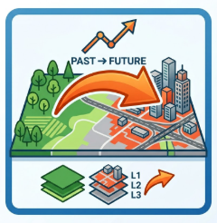
CA-Markov land change modelling exposed as three Processing algorithms: transfer analysis (fast transition-matrix preview), model training (random-forest transition potential maps) and multi-step scenario prediction with accuracy assessment. The bundled engine runs in a separate Python subprocess, so it never loads GDAL into the QGIS process. Requires numpy, scipy, scikit-learn, rasterio and matplotlib; QGIS 3.28 or newer (validated on 3.40.15 LTR). All input rasters must share the same grid and CRS. Outputs: a prediction GeoTIFF, a report, figures and a metrics JSON, shown in a dockable five-tab result panel.
| Author | LQC20504-collab |
|---|---|
| Downloads | 68 |
| Latest version | 0.1.2 |
| Last updated | 2026-11-09 (4 days ago) |
| Min QGIS | 3.28.0 |
| Max QGIS | 4.99.0 |
| QGIS 4 ready | Yes |
| Maintenance | Active |
| Categories | Raster & terrain, Spatial analysis |
| Tags | camarkov, markov, ca, landuse, landcover, raster, processing, prediction |
Homepage · Repository · Issue tracker · Official page
Alternatives in Raster & terrain
- Profile toolQGIS 4 ready
Plots terrain profile
- Qgis2threejsQGIS 4 ready
3D map visualization and web export powered by three.js JavaScript library
- SRTM-DownloaderQGIS 4 ready
Downloads SRTM Tiles from NASA Server


Related plugins
- Predictor2026Not QGIS 4 ready
Transparent hybrid land use change plugin for QGIS with editable transitions, scenario management, and RF-based suitability modeling.
- MOS-Adeupa-CENot QGIS 4 ready
Allows user to generate a landuse with cross-referring data from different origins.
- MUSCATNot QGIS 4 ready
MUSCAT (Markov-based Urban Simulation and Change Analysis Tool) is a QGIS plugin that allows users to simulate and validate land-use/land-co
- qgis2fdsNot QGIS 4 ready
Export wildfire cases to FDS and import temporal FDS results
- geeSWATQGIS 4 ready
geeSWAT is a QGIS plugin that integrates Google Earth Engine to support SWAT hydrological modelling workflows.
- WAsP scriptingQGIS 4 ready
Scripts for fetching, creating and saving WAsP map files




Maintenance: Active = updated within 1 year, Quiet = 1–3 years, Likely abandoned = over 3 years.