
Home › Spatial analysis › Predictor2026
Predictor2026 QGIS 4 compatibility
Not QGIS 4 ready Active
Not yet — the latest version declares max QGIS version 3.99.0, so it is not offered to QGIS 4 users.
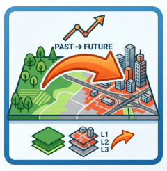
Transparent hybrid land use change plugin for QGIS with editable transitions, scenario management, and RF-based suitability modeling.
About
Predictor2026 is a scenario-oriented hybrid LULC modeling plugin integrating CA-Markov and Random Forest methods with spatial neighborhood allocation and validation tools.
| Author | Nikola V. Djokic |
|---|---|
| Downloads | 737 |
| Latest version | 10.7 |
| Last updated | 2026-04-21 (178 days ago) |
| Min QGIS | 3.0.0 |
| Max QGIS | 3.99.0 |
| QGIS 4 ready | No |
| Maintenance | Active |
| Category | Spatial analysis |
| Tags | landuse, qgis, lulc, randomforest, ca-markov, spatialmodeling, landcover |
Homepage · Repository · Issue tracker · Official page
Alternatives in Spatial analysis
- Group StatsQGIS 4 ready
Stats and analysis for vector layers data
- Data PlotlyQGIS 4 ready
D3 Plots for QGIS
- CrayfishQGIS 4 ready
Tools for mesh layers QGIS



Related plugins
- MOS-Adeupa-CENot QGIS 4 ready
Allows user to generate a landuse with cross-referring data from different origins.
- AI Edit by TerraLabQGIS 4 ready
Generative AI image editing for QGIS 3.22 to 4. Show a redevelopment, a planted street, a flood or an orthophoto redrawn as a clean site pla
- Auto LULCNot QGIS 4 ready
One-click automatic Land Use / Land Cover classification. Load your bands (or a multi-band raster), optionally supply a Landsat MTL, and get
- SELCA (Socio-Economic and Land Cover Analysis)Not QGIS 4 ready
This plugin analyzes the correlation between land cover changes and dependent variables such as population and GDRP, and provides probabilis
- SCS-CN BuilderNot QGIS 4 ready
Automated SCS Curve Number calculation from LULC and Hydrologic Soil Group data, with optional CORINE Land Cover reclassification, selectabl
- MapBiomas Collection OfficialNot QGIS 4 ready
This plugin enables the acquisition of land's use and coverage maps from MapBiomas Project (http://mapbiomas.org/) as an XYZ tile layer.






Maintenance: Active = updated within 1 year, Quiet = 1–3 years, Likely abandoned = over 3 years.