Home › Network & routing › OSMnx Routing & Isochrones

OSMnx Routing & Isochrones QGIS 4 compatibility
Not QGIS 4 ready Active
Not yet — the latest version declares max QGIS version 3.99.0, so it is not offered to QGIS 4 users.
Network routing and isochrone generation powered by OSMnx
About
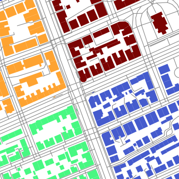
Calculate routes and reachability isochrones using OpenStreetMap street network data via OSMnx. Four Processing algorithms: download a road network to a GeoPackage, inspect it, compute one-way aware shortest paths (car or pedestrian) and generate isochrones from points or point layers. Routing runs locally on the saved network, with no routing web service or API key. Requires the Python library osmnx installed in QGIS's Python (see the homepage for a one-line install). Interface in English, Brazilian Portuguese and Spanish. Data © OpenStreetMap contributors (ODbL).
| Author | Marcello Benigno Borges de Barros Filho |
|---|---|
| Downloads | 58 |
| Latest version | 0.1.1 (experimental) |
| Last updated | 2026-10-25 (18 days ago) |
| Min QGIS | 3.28.0 |
| Max QGIS | 3.99.0 |
| QGIS 4 ready | No |
| Maintenance | Active |
| Category | Network & routing |
| Tags | osm, osmnx, routing, isochrones, network, accessibility, analysis |
Homepage · Repository · Issue tracker · Official page
Alternatives in Network & routing
- ORS ToolsQGIS 4 ready
openrouteservice routing, isochrones and matrix calculations for QGIS
- NetworksQGIS 4 ready
Designed as a processing algorithm provider. Manage linear networks and compute multimodal routing and accessibility. Several functionalitie
- TravelTime PluginQGIS 4 ready
Get travel time polygons from the TravelTime API directly from QGIS


Related plugins
- Transit Reachability AnalyserNot QGIS 4 ready
Using OpenTripPlanner to calculate public transport reachability from a starting point to all stops in a GTFS feed.
- 02Route3D - 3D Mobility StudioQGIS 4 ready
Routes for how different people really move: 15 profiles from wheelchair to truck, slope-aware paths, Pareto routes, isochrones, OD matrices
- GPS Road Builder (RidgeSlide)QGIS 4 ready
Reconstructs a connected road/path network (graph) from raw GPS tracks using the RidgeSlide density method
- NetworkForgeQGIS 4 ready
Build routable networks for Valhalla and other routers: add your own roads, cycleways and paths to OpenStreetMap, change or close streets, a
- PLN3113 NİP ve Kentsel Analiz StüdyosuQGIS 4 ready
Turkish-language studio for 1/5000 master plans (Nazım İmar Planı) in Turkey: population and MPYY amenity standards, DOP land readjustment,
- OpenTripPlanner PluginNot QGIS 4 ready
This plugin makes OpenTripPlanner 1.5 functionalities accessible from within QGIS





Maintenance: Active = updated within 1 year, Quiet = 1–3 years, Likely abandoned = over 3 years.