
Home › Web maps & export › Automatização de Memorial

Automatização de Memorial QGIS 4 compatibility
Not QGIS 4 ready Active
Not yet — the latest version declares max QGIS version 3.99.0, so it is not offered to QGIS 4 users.
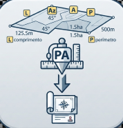
Ferramentas para preparar campos, somar perímetros e dimensões, ordenar linhas, gerar descrições de trajetos e exportar memoriais descritivos em PDF. Tools for preparing fields, calculating perimeters and dimensions, sorting lines, generating regular routes, and exporting descriptive reports in PDF. Developed for the preparation of descriptive reports in Brazil.
About
Plugin para rotinas REURB e Mapa ONR: validação cadastral e topológica, atualização automática de área/perímetro/ID, identificação de esquinas, somas, descrições e exportação de memoriais PDF.
| Author | Iasmin de Magalhães Oliveira Lopes |
|---|---|
| Downloads | 278 |
| Latest version | 1.2.2 |
| Last updated | 2026-09-17 (29 days ago) |
| Min QGIS | 3.16.0 |
| Max QGIS | 3.99.0 |
| QGIS 4 ready | No |
| Maintenance | Active |
| Category | Web maps & export |
| Tags | lotes, perímetro, mapa onr, pdf, qdlt, quadras, memorial |
Homepage · Repository · Issue tracker · Official page
Alternatives in Web maps & export
- qgis2webQGIS 4 ready
Export to an OpenLayers/Leaflet webmap
- Qgis2threejsQGIS 4 ready
3D map visualization and web export powered by three.js JavaScript library
- KML ToolsQGIS 4 ready
Fast KML/KMZ importer, exporter, with description field expansion and ground overlay to GeoTIFF conversions.


Related plugins
- Gerador de MemoriaisNot QGIS 4 ready
Generates a georeferenced descriptive report from narrative text, a QGIS layer, or a SIGEF/INCRA PDF, including points and a polygon.
- Precisa — CotasNot QGIS 4 ready
Generates length, azimuth, area and perimeter labels rotated along vector feature segments.
- QgeoNot QGIS 4 ready
This plugin loads and displays geoscientific spatial data for Queensland, Australia. Layers can be loaded using property (lot-plan) or exten
- QvegNot QGIS 4 ready
This plugin loads Queensland vegetation management data from the Queensland government feature server. Layers can be loaded using property (
- CDU CreatorNot QGIS 4 ready
This plugin creates the .pdf file of CDU (Certificato di Destinazione Urbanistica).
- PdfExtractQGIS 4 ready
Converts PDF files to DXF, Shapefile, Geojson format using PyMuPDF and ezdxf.





Maintenance: Active = updated within 1 year, Quiet = 1–3 years, Likely abandoned = over 3 years.