
Home › Network & routing › AwaP

AwaP QGIS 4 compatibility
Not QGIS 4 ready Quiet
Not yet — the latest version declares max QGIS version 3.99.0, so it is not offered to QGIS 4 users.
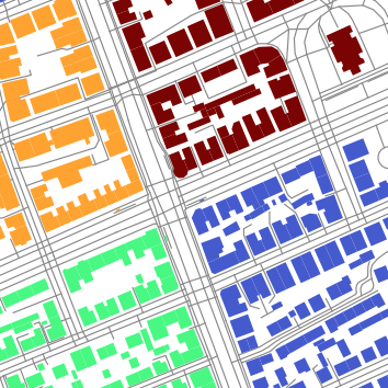
This plugin takes in outlines of urban blocks and the boundary of area of interest, and calculates area-weighted average parameter (AwaP)
About
This plugin calculates area-weighted average perimeter (AwaP) of urban blocks within the defined area. The tool removes dead-end streets up to a specified maximum street width. This method was first presented in Pafka E. and Dovey K. (2017), Permeability and interface catchment: measuring and mapping walkable access (https://www.tandfonline.com/doi/abs/10.1080/17549175.2016.1220413); and this plugin is presented in Majic I. and Pafka E. (2019), AwaP-IC - An Open-Source GIS Tool for Measuring Walkable Access (https://www.mdpi.com/2413-8851/3/2/48). The video tutorial for AwaP is available online (https://vimeo.com/elekpafka/awap).
| Author | Ivan Majic |
|---|---|
| Downloads | 11,071 |
| Latest version | 2.0.2 |
| Last updated | 2024-09-13 (763 days ago) |
| Min QGIS | 3.0.0 |
| Max QGIS | 3.99.0 |
| QGIS 4 ready | No |
| Maintenance | Quiet |
| Category | Network & routing |
| Tags | urban morphology, permeability, street network |
Homepage · Repository · Issue tracker · Official page
Alternatives in Network & routing
- ORS ToolsQGIS 4 ready
openrouteservice routing, isochrones and matrix calculations for QGIS
- NetworksQGIS 4 ready
Designed as a processing algorithm provider. Manage linear networks and compute multimodal routing and accessibility. Several functionalitie
- TravelTime PluginQGIS 4 ready
Get travel time polygons from the TravelTime API directly from QGIS


Related plugins
- ALHAMBRANot QGIS 4 ready
ALHAMBRA is a QGIS plugin for analyzing metropolitan agglomeration through road-network morphology, multi-origin fractal box counting, chara
- LUCIANot QGIS 4 ready
LUCIA Lynch Urban Computational Image Analyzer is a QGIS plugin for evaluating urban legibility, imageability, and cognitive urban structure
- Interface CatchmentNot QGIS 4 ready
Calculates the interface catchment on urban blocks within a specified walking distance.
- iso4appQGIS 4 ready
iso4app isochrone/isodistance
- Transit Reachability AnalyserNot QGIS 4 ready
Using OpenTripPlanner to calculate public transport reachability from a starting point to all stops in a GTFS feed.
- CityseerQGIS 4 ready
Urban network analysis: centrality, demand flows, accessibility, mixed uses, and statistics





Maintenance: Active = updated within 1 year, Quiet = 1–3 years, Likely abandoned = over 3 years.