
Home › Web maps & export › QShare

QShare QGIS 4 compatibility
QGIS 4 ready Active
Yes — QShare supports QGIS 4 (declared max version 4.99.0).
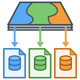
Export a packaged QGIS project (layers + images + .qgz) preserving the layer tree group structure. Output as folder or ZIP, no external dependencies.
About
Package the active project: copy the vector layers (as SHP files mirroring the layer tree group structure, or in a single GPKG with table names that reflect the original groups), local rasters, and images used in layouts; rewrite the paths as relative; and save the .qgz file along with everything else. WMS/WMTS layers are retained with their original URLs. Export as a folder or as a .zip file. Does not modify the active project in QGIS.
| Author | Aarón Quesada — ISLAYA Consultoría Ambiental |
|---|---|
| Downloads | 1,888 |
| Latest version | 0.1.3 |
| Last updated | 2026-04-29 (169 days ago) |
| Min QGIS | 3.22.0 |
| Max QGIS | 4.99.0 |
| QGIS 4 ready | Yes |
| Maintenance | Active |
| Categories | Web maps & export, Database, Vector tools |
| Tags | zip, shapefile, package, project, export, geopackage |
Homepage · Repository · Issue tracker · Official page
Alternatives in Web maps & export
- qgis2webQGIS 4 ready
Export to an OpenLayers/Leaflet webmap
- Qgis2threejsQGIS 4 ready
3D map visualization and web export powered by three.js JavaScript library
- KML ToolsQGIS 4 ready
Fast KML/KMZ importer, exporter, with description field expansion and ground overlay to GeoTIFF conversions.


Related plugins
- GeopackerQGIS 4 ready
Bundles an entire QGIS project (.qgz) into an easily shareable, single compressed file. Consolidates vectors, rasters, layout images, and .q
- Zapisz projekt do GPKG (warstwy i style)Not QGIS 4 ready
Zapisuje wybrane warstwy projektu do jednego pliku GeoPackage razem z symbolizacją (styl domyślny w GPKG) i kolejnością warstw — cały projek
- GeoPackage ConverterQGIS 4 ready
Batch convert vector and raster files (SHP, TAB, KML, GML, GeoJSON, DXF, GPX, MIF, ZIP, RAR, TIF, ASC, IMG…) and remote layers (WFS, WCS, Ar
- QGIS Project HandoffQGIS 4 ready
Create conservative QGIS project handoff folders and ZIP packages from local file-backed data sources.
- Stratified PackagerQGIS 4 ready
Exports vector layers to multiple geopackages split by attributes or spatial intersection
- TransformerQGIS 4 ready
Controlled QGIS attribute manager for vector layers: precise fields, smart filters, repeatable JSON configurations, export, and PostgreSQL p




Maintenance: Active = updated within 1 year, Quiet = 1–3 years, Likely abandoned = over 3 years.