Home › Hydrology & water › Water Drop

Water Drop QGIS 4 compatibility
Not QGIS 4 ready Active
Not yet — the latest version declares max QGIS version 3.99.0, so it is not offered to QGIS 4 users.
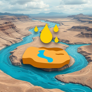
Trace a steepest-downhill path across a selected DEM using an eight-neighbour raster method.
About
Creates a downhill water-drop path from a user-selected starting point on an active raster DEM. For better experience, convert the DEM to Fill Sinks (Wang and Liu).
| Author | Mayuresh Padalkar |
|---|---|
| Downloads | 44 |
| Latest version | 1.0.0 |
| Last updated | 2026-11-09 (4 days ago) |
| Min QGIS | 3.22.0 |
| Max QGIS | 3.99.0 |
| QGIS 4 ready | No |
| Maintenance | Active |
| Categories | Hydrology & water, Raster & terrain |
| Tags | hydrology, water-drop, flow-path, drainage, dem, terrain-analysis, flow-direction, trace |
Homepage · Repository · Issue tracker · Official page
Alternatives in Hydrology & water
- CrayfishQGIS 4 ready
Tools for mesh layers QGIS
- ArcGeek CalculatorQGIS 4 ready
ArcGeek Calculator is a QGIS plugin that provides a comprehensive set of tools for coordinate calculations, conversions, spatial operations,
- TUFLOWQGIS 4 ready
A collection of utilities for TUFLOW flood and coastal simulation in QGIS



Related plugins
- Stormwater Drainage Plot and DesignQGIS 4 ready
Plot TUFLOW pipe and pit layers as a long section, and design new stormwater pipe runs on it.
- River Slope CalculatorQGIS 4 ready
Calculate river reach slope from a DEM using Average Slope or Equal Area Slope. Output unit selectable: m/m or %.
- Basdonax Keyline from DEMQGIS 4 ready
Computational design of Keyline infiltration lines from DEM/DTM.
- HandModelNot QGIS 4 ready
QGIS plugin for hydrological and geomorphological analysis using DEMs, with slope quartiles and drainage extraction.
- Pghydro ToolsNot QGIS 4 ready
PgHydro Tools Interface for PgHydro Extension for PostgreSQL/PostGIS
- Rain to Flood AnalysisQGIS 4 ready
Rainfall-to-flood analysis for QGIS. Delineates the upstream catchment and longest flow path from a single pour point, downloads and analyse



Maintenance: Active = updated within 1 year, Quiet = 1–3 years, Likely abandoned = over 3 years.