
Home › Vector tools › Measures of Compactness
Measures of Compactness QGIS 4 compatibility
QGIS 4 ready Quiet
Yes — Measures of Compactness supports QGIS 4 (declared max version 4.99.0).
This plugin adds various functions expression to measure the degree of compactness of a geometry(ies) (Polsby–Popper, Reock, Skew, etc...)
About
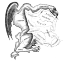
This plugin adds some common ways to measure the compactness through function expressions These functions are particularly useful to detect gerrymandering, evaluate the regularity of a parcel, lot, etc... For an introduction on geometry and compactness, see the wonderful `Math for the people` course <a href="https://web.stevenson.edu/mbranson/m4tp/version1/gerrymandering-math-topic-compactness.html">https://web.stevenson.edu/mbranson/m4tp/version1/gerrymandering-math-topic-compactness.html</a>
| Author | Valentin Buira |
|---|---|
| Downloads | 987 |
| Latest version | 0.1.0 |
| Last updated | 2025-09-12 (398 days ago) |
| Min QGIS | 3.16.0 |
| Max QGIS | 4.99.0 |
| QGIS 4 ready | Yes |
| Maintenance | Quiet |
| Category | Vector tools |
| Tags | compactness, fucktrump, expression, geometry, field-calculator, districting, redistricting, democracy, gerrymandering |
Homepage · Repository · Issue tracker · Official page
Alternatives in Vector tools
- HCMGISQGIS 4 ready
HCMGIS - Basemaps, Download OpenData, Batch Converter, VN-2000 Projections, and Field Calculation Utilities
- mmqgisQGIS 4 ready
A collection of QGIS vector layer operation plugins
- Shape ToolsQGIS 4 ready
Shape Tools is a collection of geodesic shapes and tools. Create circle, ellipse, line of bearing, points along a line of bearing, concentri


Related plugins
- QGIS RedistrictingNot QGIS 4 ready
Tool for drawing districting plans from geographic units
- Redistricting for QGISNot QGIS 4 ready
Electorate Redistricting and Equalisation
- Geohash Expressions PluginQGIS 4 ready
This plugin adds expression functions to work with geohash in the field calculator
- YAAP(Yet Another Animation Plugin)QGIS 4 ready
Turn QGIS into a video editing software
- Statto Redistricter QGISv3Not QGIS 4 ready
Easily create political districts of equal population
- PlanXQGIS 4 ready
Embedded urban analytics engine: space syntax (segment angular analysis), network centrality, urban morphology, OD matrices, OD shortest-pat





Maintenance: Active = updated within 1 year, Quiet = 1–3 years, Likely abandoned = over 3 years.