Home › Vector tools › GPKG Merger

GPKG Merger QGIS 4 compatibility
QGIS 4 ready Active
Yes — GPKG Merger supports QGIS 4 (declared max version 4.99.0).
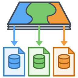
Merge several GeoPackage files – layers, rasters, tables, styles, metadata and QGIS projects – into one, with a user-defined merge order and three ways to handle objects with the same name (rename, overwrite, append).
About
Merge any number of GeoPackages – with everything stored in them – into a new GeoPackage. - Copies vector and attribute layers (with field aliases, comments and value domains), raster tiles, DEMs (gridded coverages), vector tiles, plain tables, views, metadata, related-table relations, QGIS layer styles and QGIS projects. - QGIS projects stored in the files are redirected to the merged file, including renamed layers. - Set the merge order by drag & drop or the up/down buttons. - Layers with the same name (compared case-insensitively) can be: * kept and renamed to <gpkg name>_<layer name>, * overwritten – the file that comes later in the order wins, * appended into one layer – geometry type, CRS and fields are checked first; if they do not match nothing is written and you can change the selection. - A preview shows the result of every layer before merging. - QGIS layer styles stored in the files (layer_styles) follow their layers. - The user interface follows the QGIS language setting: English, Traditional Chinese, Simplified Chinese, Japanese, Korean, German, French, Spanish. Works with QGIS 3.22+ and QGIS 4 (Qt6). Uses only GDAL/OGR which ships with QGIS; no extra Python packages needed.
| Author | yoshi |
|---|---|
| Downloads | 185 |
| Latest version | 1.2.1 |
| Last updated | 2026-10-26 (18 days ago) |
| Min QGIS | 3.22.0 |
| Max QGIS | 4.99.0 |
| QGIS 4 ready | Yes |
| Maintenance | Active |
| Categories | Vector tools, Database, Raster & terrain |
| Tags | geopackage, gpkg, merge, vector, layers, append, combine, raster, project |
Homepage · Repository · Issue tracker · Official page
Alternatives in Vector tools
- HCMGISQGIS 4 ready
HCMGIS - Basemaps, Download OpenData, Batch Converter, VN-2000 Projections, and Field Calculation Utilities
- mmqgisQGIS 4 ready
A collection of QGIS vector layer operation plugins
- Shape ToolsQGIS 4 ready
Shape Tools is a collection of geodesic shapes and tools. Create circle, ellipse, line of bearing, points along a line of bearing, concentri


Related plugins
- Zapisz projekt do GPKG (warstwy i style)Not QGIS 4 ready
Dwujęzyczna (PL/EN). Zapisuje wybrane warstwy projektu do jednego pliku GeoPackage razem z symbolizacją (styl domyślny w GPKG) i kolejnością
- Stratified PackagerQGIS 4 ready
Exports vector layers to multiple geopackages split by attributes or spatial intersection
- Load Them AllQGIS 4 ready
Loads files stored in a directory structure recursively, based on several filters
- Model BakerQGIS 4 ready
Model Baker creates QGIS projects from models or database schemas
- Append Features to LayerQGIS 4 ready
Processing plugin-based provider that adds an algorithm for appending/updating features to a vector layer
- MapotecaNot QGIS 4 ready
Automatic inventory and auditing of geospatial data in file systems




Maintenance: Active = updated within 1 year, Quiet = 1–3 years, Likely abandoned = over 3 years.