

GPKG Editor QGIS 4 compatibility
QGIS 4 ready Active
Yes — GPKG Editor supports QGIS 4 (declared max version 4.99.0).
View and edit GeoPackage (GPKG) layer attributes with plan management and GPKG/CSV export.
About
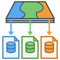
Manage multiple named plans against a single GPKG — switch and compare them instantly without duplicating files. All plans and attribute edits are stored in one companion file ({name}_data.sqlite), leaving the original GPKG untouched. Each plan holds a feature set with column configuration; edits are merged only at export time (GPKG/CSV). Also features expression-based status rows and a lock mode that freezes the canvas for spatial comparison. Support: https://paypal.me/rawslnc
| Author | Hideharu Masai |
|---|---|
| Downloads | 3,170 |
| Latest version | 1.1.0 |
| Last updated | 2026-10-10 (5 days ago) |
| Min QGIS | 4.0.0 |
| Max QGIS | 4.99.0 |
| QGIS 4 ready | Yes |
| Maintenance | Active |
| Categories | Database, Vector tools |
| Tags | vector, plan, attribute, editor, table, geopackage, gpkg |
Homepage · Repository · Issue tracker · Official page
Alternatives in Database
- QGIS Cloud PluginQGIS 4 ready
Publish maps on qgiscloud.com
- DSG ToolsQGIS 4 ready
Brazilian Army Cartographic Production Tools
- DB Manager (community)QGIS 4 ready
Manage your databases within QGIS.



Related plugins
- Compartment CompassQGIS 4 ready
Filter, search, and edit vector layer attributes in a spreadsheet-style table that stays in sync with the map — find the feature first, then
- FeatureNavEdQGIS 4 ready
Navigate and edit vector layer features one by one with attribute display, sorting, and auto-zoom. Dockable panel with previous/next navigat
- Attribute Batch EditorQGIS 4 ready
Batch edit attribute values with prefix, suffix, replace, find and replace, auto increment, fill empty, boolean, and date operations. Please
- Load Them AllQGIS 4 ready
Loads files stored in a directory structure recursively, based on several filters
- MapotecaNot QGIS 4 ready
Automatic inventory and auditing of geospatial data in file systems
- Stratified PackagerQGIS 4 ready
Exports vector layers to multiple geopackages split by attributes or spatial intersection



Maintenance: Active = updated within 1 year, Quiet = 1–3 years, Likely abandoned = over 3 years.