
Home › Field data & mobile › GNSS_Pos2QGIS

GNSS_Pos2QGIS QGIS 4 compatibility
Not QGIS 4 ready Active
Not yet — the latest version declares max QGIS version 3.99.0, so it is not offered to QGIS 4 users.
Advanced importer for GNSS/RTK data (.pos). Filters coordinates by precision, reprojects on-the-fly, and generates features with automatic area calculation.
About
Developed to optimize environmental licensing and topography workflows. This plugin automates the reading of RTK receiver output files (.pos), filters outliers based on standard deviation and satellite count, reprojects coordinates on-the-fly, smooths paths, and outputs the final geometry with calculated attributes (hectares and meters) directly into QGIS.
| Author | Gabriel Aoki |
|---|---|
| Downloads | 110 |
| Latest version | 0.2 (experimental) |
| Last updated | 2026-09-09 (36 days ago) |
| Min QGIS | 3.0.0 |
| Max QGIS | 3.99.0 |
| QGIS 4 ready | No |
| Maintenance | Active |
| Categories | Field data & mobile, Coordinates & projections |
| Tags | gnss, rtk, ppk, environment, topography, python |
Homepage · Repository · Issue tracker · Official page
Alternatives in Field data & mobile
- QField SyncQGIS 4 ready
Sync your projects to QField
- ImportPhotosQGIS 4 ready
Import Photos
- Mergin MapsQGIS 4 ready
Handle Mergin Maps projects



Related plugins
- YF GIS Amazonia ToolsQGIS 4 ready
Suite de 18 herramientas GIS para catastro, gestion forestal y topografia en la Amazonia peruana.
- Precisa — RBMC / Efemérides / PPKNot QGIS 4 ready
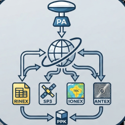
Automated download of RINEX, SP3, IONEX, ANTEX, hgeoHNOR2020 and a full PPK kit, with an optional AI co-pilot for ephemeris and RBMC (BRAZIL
- Recalculo RTK a Coordenadas AjustadasQGIS 4 ready
Recalculates field points collected against a "free" RTK base to the base's adjusted coordinates from static GNSS post-processing (plane and
- GNSSeismicQGIS 4 ready
Plugin bilingüe (ES/EN) para topografía RTK/GNSS y sísmica: proyectos con base de datos PREPLOT/POSTPLOT, importación de .dc aplicando un mo
- EarthWorkQQGIS 4 ready
Earthwork quantities for sites and road corridors: weighted grid integration and end-area sections, void-ratio volume conversion, daylighted
- LF ToolsQGIS 4 ready
Comprehensive solutions for cartographic production, surveying, drone mapping, GNSS data import, geospatial database management, digital ima





Maintenance: Active = updated within 1 year, Quiet = 1–3 years, Likely abandoned = over 3 years.