
Home › Data download & OSM › geobr
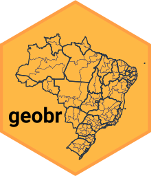
geobr QGIS 4 compatibility
QGIS 4 ready Active
Yes — geobr supports QGIS 4 (declared max version 4.99.0).
Download official spatial data sets of Brazil as QGIS layers
About
Easy access to official spatial data sets of Brazil. The plugin offers a wide range of official spatial data sets available at various geographic scales and for various years with harmonized attributes, projection and fixed topology. This includes states, municipalities, census tracts, biomes, indigenous lands, health facilities, schools, favelas and more. All original data sets come from IBGE and other official Brazilian sources and are returned in EPSG:4674 (SIRGAS 2000). This QGIS plugin is built on top of the geobr Python library, which integrates seamlessly with DuckDB and geopandas, and can be used from the Processing Toolbox, chained in Model Builder, run in batch, or called from qgis_process. The geobr library is bundled with the plugin, so there is nothing to pip-install. DuckDB, the engine geobr runs on, is installed for you by the qpip plugin, which QGIS offers to install alongside this one; if you skip qpip, install it into the Python QGIS uses: python -m pip install --user "duckdb>=1.5.3". Everything else geobr needs ships with the official QGIS builds for Windows and macOS; a Linux distribution build of QGIS may lack geopandas or pyarrow, and the plugin says so at startup.
| Author | Rafael H. M. Pereira, Ipea |
|---|---|
| Downloads | 631 |
| Latest version | 0.4.1 |
| Last updated | 2026-09-24 (22 days ago) |
| Min QGIS | 3.40.0 |
| Max QGIS | 4.99.0 |
| QGIS 4 ready | Yes |
| Maintenance | Active |
| Categories | Data download & OSM, Vector tools |
| Tags | brazil, ibge, boundaries, census, municipality, opendata, vector, ipea, official data |
Homepage · Repository · Issue tracker · Official page
Alternatives in Data download & OSM
- NextGIS QuickMapServicesQGIS 4 ready
Quickly find and add basemaps and geodata services to your project in one click using the open QMS catalog
- QuickOSMQGIS 4 ready
Download OSM data thanks to the Overpass API. You can also open local OSM or PBF files. A special parser, on top of OGR, is used to let you
- HCMGISQGIS 4 ready
HCMGIS - Basemaps, Download OpenData, Batch Converter, VN-2000 Projections, and Field Calculation Utilities



Related plugins
- GisBRQGIS 4 ready
Load official Brazilian spatial data (IBGE/IPEA geobr + censobr), build an OSM road network with real topology and connectivity checks, and
- istat_confini_pluginQGIS 4 ready
Plugin per scaricare confini amministrativi ISTAT e griglia di popolazione 2021 su standard europeo
- INDEQGIS 4 ready
Plugin to access the OWS services of INDE – Brazil's National Spatial Data Infrastructure.
- agrobrQGIS 4 ready
Brazilian agricultural data in QGIS via agrobr library
- FBDS SearchQGIS 4 ready
Creates environmental masks from FBDS data using an area selected in QGIS.
- IMI Rates Portugal (flatin.pt)QGIS 4 ready
Adds a map layer with the yearly IMI (municipal property tax) rate of all 308 municipalities of Portugal, styled by rate, with official boun





Maintenance: Active = updated within 1 year, Quiet = 1–3 years, Likely abandoned = over 3 years.