
Home › Cartography & layout › Embed Legend

Embed Legend QGIS 4 compatibility
QGIS 4 ready Active
Yes — Embed Legend supports QGIS 4 (declared max version 4.99.0).
Interactive Floating Legend & Advanced KMZ/MIF Thematic Export Tool for RF Engineers and GIS Analysts.
About
Embed Legend is the ultimate productivity booster for QGIS users, particularly in the Telecommunications and GIS sectors. It creates a live, draggable floating legend panel that stays on your map canvas. Key features include: * Interactive visibility toggle (click to hide/show layers with a strikethrough effect). * Multi-layer stacking with clear separators. * Real-time feature counts and percentage (%) statistics. * Professional KMZ (Google Earth) export with auto-embedded legend images on the screen. * Smart Labeling: Automatically detects SiteID columns for Sectoral/Polygon layers, keeping Drive Test (Points) and Grid geometries clean without text clutter. * Direct MapInfo MIF export with hardcoded thematics. Export thousands of complex RF data points (Drive Test, Covmo/MR/MDT, Gcell) cleanly and efficiently in less than a minute.
| Author | Jujun Junaedi |
|---|---|
| Downloads | 2,979 |
| Latest version | 6.9.2 |
| Last updated | 2026-03-15 (215 days ago) |
| Min QGIS | 3.16.0 |
| Max QGIS | 4.99.0 |
| QGIS 4 ready | Yes |
| Maintenance | Active |
| Categories | Cartography & layout, Web maps & export |
| Tags | google earth, export, kml, mapinfo, mif, legend, kmz, rf, thematic, drive test, telecommunications |
Homepage · Repository · Issue tracker · Official page
Alternatives in Cartography & layout
- LF ToolsQGIS 4 ready
Comprehensive solutions for cartographic production, surveying, drone mapping, GNSS data import, geospatial database management, digital ima
- MaskQGIS 4 ready
Help to create mask, filter labels in it
- TimeManagerQGIS 4 ready
Create animations visualizing spatio-temporal data



Related plugins
- Site SectorNot QGIS 4 ready
Generate dynamic sectoral site wedges and PCI audits.
- RSRP Thematic ConverterQGIS 4 ready
Import CSV or GeoPackage data, style it by RSRP, and export the result as KMZ for Google Earth.
- Export 2KMLQGIS 4 ready
Batch‐export vector and raster layers into a single KML or KMZ with QGIS styling. Part of MAS Vector Processing tools.
- Batch KMZ ExporterQGIS 4 ready
Export one or multiple selected layers (with symbology, labels, and attributes preserved exactly as shown on the map) into a single combined
- Precisa GEO 2 EarthNot QGIS 4 ready
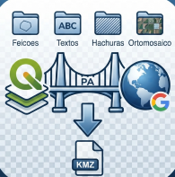
Exports QGIS layers to a KMZ organized in folders (Features, Labels, Hatching, Orthomosaic), preserving the current symbology.
- DipStrike To KMZQGIS 4 ready
Exports dip/strike point layers to KMZ with fully preserved symbol rotation. Fixes the rotation loss bug in QGIS's built-in KMZ exporter.





Maintenance: Active = updated within 1 year, Quiet = 1–3 years, Likely abandoned = over 3 years.