
Home › Raster & terrain › Topographic Profile

Topographic Profile QGIS 4 compatibility
QGIS 4 ready Active
Yes — Topographic Profile supports QGIS 4 (declared max version 4.99.0).
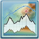
This plugin generate a topographic profile from a CSV file.
About
This plugin, by providing a csv file, generate a topographical elevation profile. The csv must almost contain: peg number, ground levels, progressive distance as well as other optional information
| Author | Giulio Fattori |
|---|---|
| Downloads | 29,849 |
| Latest version | 1.3 |
| Last updated | 2026-03-14 (216 days ago) |
| Min QGIS | 4.0.0 |
| Max QGIS | 4.99.0 |
| QGIS 4 ready | Yes |
| Maintenance | Active |
| Category | Raster & terrain |
| Tags | python, profile, topographic |
Homepage · Repository · Issue tracker · Official page
Alternatives in Raster & terrain
- Profile toolQGIS 4 ready
Plots terrain profile
- Qgis2threejsQGIS 4 ready
3D map visualization and web export powered by three.js JavaScript library
- SRTM-DownloaderQGIS 4 ready
Downloads SRTM Tiles from NASA Server


Related plugins
- TopoProfile StudioQGIS 4 ready
Professional elevation profiles from DEMs or contour lines, featuring an interactive chart, map indicator, geological/structural markers, mu
- Topo MapsNot QGIS 4 ready
微地形図の生成。Generate Topographic Maps.
- Forestry Operations LiteQGIS 4 ready
Terrain analysis for forestry sites: DEM/DSM loading, slope, TWI, stability index, CS MAP export, and time-area flow-load estimation.
- Raster VectorizerNot QGIS 4 ready
Vectorize scanned topographic maps using interactive HSV colour-range classification
- Contour LabelerQGIS 4 ready
Place slope-aligned elevation labels on contours along guide lines drawn uphill.
- Temporal/Spectral Profile ToolNot QGIS 4 ready
Plots profile from raster bands. Based on Profile Tool.



Maintenance: Active = updated within 1 year, Quiet = 1–3 years, Likely abandoned = over 3 years.