
Home › Cartography & layout › SmartLineLabeler
SmartLineLabeler QGIS 4 compatibility
QGIS 4 ready Active
Yes — SmartLineLabeler supports QGIS 4 (declared max version 4.99.0).
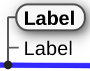
SmartLineLabeler is a QGIS plugin that automatically creates clean, readable, stacked labels for overlapping line features—ideal for utilities, telecom cables, pipelines, and any dense linear network. It lets you interactively draw label positions and generates a dedicated label layer with customizable HTML-styled text for professional cartographic output.
About
✨ Key Features - Stacked labels for overlapping lines: Automatically generates multi‑line label blocks for all features intersecting your drawn placement line. - Interactive label placement: Draw a short “rubber band” line to define the exact position and angle of the label group. - Dedicated label layer: Creates a temporary or permanent layer containing the generated labels, keeping your source data untouched. - HTML-based label styling: Supports bold, color, multi-line formatting, and other HTML features for highly readable technical labels. - Configurable attribute mapping: Choose which fields to include in the label and how they should be formatted. - Ideal for utilities and infrastructure mapping: Works especially well for telecom cables, pipelines, fiber bundles, and other dense linear datasets.
| Author | Christoph Candido |
|---|---|
| Downloads | 1,278 |
| Latest version | 4.0.0 |
| Last updated | 2026-04-11 (188 days ago) |
| Min QGIS | 3.0.0 |
| Max QGIS | 4.99.0 |
| QGIS 4 ready | Yes |
| Maintenance | Active |
| Category | Cartography & layout |
| Tags | vector, labeling, line |
Homepage · Repository · Issue tracker · Official page
Alternatives in Cartography & layout
- LF ToolsQGIS 4 ready
Comprehensive solutions for cartographic production, surveying, drone mapping, GNSS data import, geospatial database management, digital ima
- MaskQGIS 4 ready
Help to create mask, filter labels in it
- TimeManagerQGIS 4 ready
Create animations visualizing spatio-temporal data



Related plugins
- Adjust StyleQGIS 4 ready
Quickly adjust the symbology (colors, stroke, font) for all layers.
- Label ConnectorNot QGIS 4 ready
This plugin creates label connector (line from centroid to the label)
- Distance_3DNot QGIS 4 ready
DE: Beschrifte einen Layer mit der 3D-Länge und dem Azimut. EN: Label a layer with the 3D length and azimuth.
- AcATaMaQGIS 4 ready
AcATaMa is a powerful and complete Qgis plugin for accuracy assessment that provides comprehensive support for sampling, response design and
- EasyCustomLabelingNot QGIS 4 ready
Allows to quickly duplicate layer into memory layer ready for data defined labeling. Requires Memory layer Saver >= 3.2 to restore all labe
- Deactivate Active LabelsNot QGIS 4 ready
on/off layer’s label





Maintenance: Active = updated within 1 year, Quiet = 1–3 years, Likely abandoned = over 3 years.